Buire-sur-l'Ancre | |
|---|---|
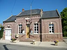 The town hall in Buire-sur-l'Ancre | |
Location of Buire-sur-l'Ancre | |
 Buire-sur-l'Ancre  Buire-sur-l'Ancre | |
| Coordinates: 49°57′56″N 2°35′35″E / 49.9656°N 2.5931°E | |
| Country | France |
| Region | Hauts-de-France |
| Department | Somme |
| Arrondissement | Péronne |
| Canton | Albert |
| Intercommunality | Pays du Coquelicot |
| Government | |
| • Mayor (2020–2026) | Jean-Christian Ruin[1] |
| Area 1 | 5.28 km2 (2.04 sq mi) |
| Population | 300 |
| • Density | 57/km2 (150/sq mi) |
| Time zone | UTC+01:00 (CET) |
| • Summer (DST) | UTC+02:00 (CEST) |
| INSEE/Postal code | 80151 /80300 |
| Elevation | 38–102 m (125–335 ft) (avg. 43 m or 141 ft) |
| 1 French Land Register data, which excludes lakes, ponds, glaciers > 1 km2 (0.386 sq mi or 247 acres) and river estuaries. | |
Buire-sur-l'Ancre (French pronunciation: [bɥiʁ syʁ lɑ̃kʁ], literally Buire on the Ancre; Picard: Buire-su-l'Inque) is a commune in the Somme department in Hauts-de-France in northern France.
Geography
The commune is situated on the D52 road, some 16 miles (26 km) northwest of Amiens.
Population
| Year | Pop. | ±% p.a. |
|---|---|---|
| 1968 | 301 | — |
| 1975 | 293 | −0.38% |
| 1982 | 283 | −0.49% |
| 1990 | 304 | +0.90% |
| 1999 | 312 | +0.29% |
| 2007 | 330 | +0.70% |
| 2012 | 313 | −1.05% |
| 2017 | 310 | −0.19% |
| Source: INSEE[3] | ||
See also
References
- ↑ "Répertoire national des élus: les maires". data.gouv.fr, Plateforme ouverte des données publiques françaises (in French). 2 December 2020.
- ↑ "Populations légales 2021". The National Institute of Statistics and Economic Studies. 28 December 2023.
- ↑ Population en historique depuis 1968, INSEE
Wikimedia Commons has media related to Buire-sur-l'Ancre.
This article is issued from Wikipedia. The text is licensed under Creative Commons - Attribution - Sharealike. Additional terms may apply for the media files.