Předslav | |
|---|---|
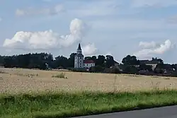 General view | |
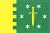 Flag 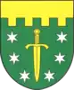 Coat of arms | |
 Předslav Location in the Czech Republic | |
| Coordinates: 49°26′51″N 13°21′16″E / 49.44750°N 13.35444°E | |
| Country | |
| Region | Plzeň |
| District | Klatovy |
| First mentioned | 1352 |
| Area | |
| • Total | 19.60 km2 (7.57 sq mi) |
| Elevation | 420 m (1,380 ft) |
| Population (2023-01-01)[1] | |
| • Total | 826 |
| • Density | 42/km2 (110/sq mi) |
| Time zone | UTC+1 (CET) |
| • Summer (DST) | UTC+2 (CEST) |
| Postal codes | 339 01 |
| Website | predslav |
Předslav is a municipality and village in Klatovy District in the Plzeň Region of the Czech Republic. It has about 800 inhabitants.
Předslav lies approximately 8 kilometres (5 mi) north-east of Klatovy, 34 km (21 mi) south of Plzeň, and 105 km (65 mi) south-west of Prague.
Administrative parts
Villages of Hůrka, Makov, Měcholupy, Němčice, Petrovičky and Třebíšov are administrative parts of Předslav.
References
Wikimedia Commons has media related to Předslav.
This article is issued from Wikipedia. The text is licensed under Creative Commons - Attribution - Sharealike. Additional terms may apply for the media files.