Vrhaveč | |
|---|---|
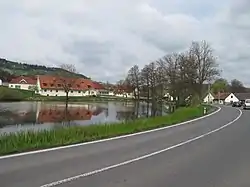 A pond in the centre of Vrhaveč | |
 Vrhaveč Location in the Czech Republic | |
| Coordinates: 49°20′44″N 13°17′47″E / 49.34556°N 13.29639°E | |
| Country | |
| Region | Plzeň |
| District | Klatovy |
| First mentioned | 1379 |
| Area | |
| • Total | 12.11 km2 (4.68 sq mi) |
| Elevation | 427 m (1,401 ft) |
| Population (2023-01-01)[1] | |
| • Total | 891 |
| • Density | 74/km2 (190/sq mi) |
| Time zone | UTC+1 (CET) |
| • Summer (DST) | UTC+2 (CEST) |
| Postal code | 339 01 |
| Website | www |
Vrhaveč is a municipality and village in Klatovy District in the Plzeň Region of the Czech Republic. It has about 900 inhabitants.
Vrhaveč lies approximately 7 kilometres (4 mi) south of Klatovy, 46 km (29 mi) south of Plzeň, and 116 km (72 mi) south-west of Prague.
Administrative parts
Villages of Malá Víska, Neznašovy and Radinovy are administrative parts of Vrhaveč.
References
Wikimedia Commons has media related to Vrhaveč.
This article is issued from Wikipedia. The text is licensed under Creative Commons - Attribution - Sharealike. Additional terms may apply for the media files.