Saint-Auban-sur-l'Ouvèze | |
|---|---|
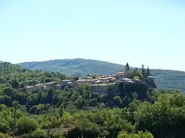 A general view of Saint-Auban-sur-l'Ouvèze | |
Location of Saint-Auban-sur-l'Ouvèze | |
 Saint-Auban-sur-l'Ouvèze  Saint-Auban-sur-l'Ouvèze | |
| Coordinates: 44°17′00″N 5°25′00″E / 44.2833°N 5.4167°E | |
| Country | France |
| Region | Auvergne-Rhône-Alpes |
| Department | Drôme |
| Arrondissement | Nyons |
| Canton | Nyons et Baronnies |
| Government | |
| • Mayor (2020–2026) | Véronique Chauvet[1] |
| Area 1 | 16.55 km2 (6.39 sq mi) |
| Population | 213 |
| • Density | 13/km2 (33/sq mi) |
| Time zone | UTC+01:00 (CET) |
| • Summer (DST) | UTC+02:00 (CEST) |
| INSEE/Postal code | 26292 /26170 |
| Elevation | 564–1,352 m (1,850–4,436 ft) (avg. 637 m or 2,090 ft) |
| 1 French Land Register data, which excludes lakes, ponds, glaciers > 1 km2 (0.386 sq mi or 247 acres) and river estuaries. | |
Saint-Auban-sur-l'Ouvèze (French pronunciation: [sɛ̃.t‿obɑ̃ syʁ luvɛz], literally Saint Auban on the Ouvèze; Occitan: Sant Auban d'Ovèsa) is a commune in the Drôme department in southeastern France.
Population
| Year | Pop. | ±% p.a. |
|---|---|---|
| 1968 | 215 | — |
| 1975 | 206 | −0.61% |
| 1982 | 213 | +0.48% |
| 1990 | 200 | −0.78% |
| 1999 | 188 | −0.69% |
| 2009 | 218 | +1.49% |
| 2014 | 217 | −0.09% |
| 2020 | 212 | −0.39% |
| Source: INSEE[3] | ||
See also
References
- ↑ "Répertoire national des élus: les maires" (in French). data.gouv.fr, Plateforme ouverte des données publiques françaises. 13 September 2022.
- ↑ "Populations légales 2021". The National Institute of Statistics and Economic Studies. 28 December 2023.
- ↑ Population en historique depuis 1968, INSEE
Wikimedia Commons has media related to Saint-Auban-sur-l'Ouvèze.
This article is issued from Wikipedia. The text is licensed under Creative Commons - Attribution - Sharealike. Additional terms may apply for the media files.