 | |
|---|---|
| Route information | |
| Maintained by Ministry of Land, Infrastructure, Transport and Tourism | |
| Length | 19.5 km[1] (12.1 mi) |
| Existed | 2002–present |
| Component highways | |
| Major junctions | |
| West end | Namioka Interchange |
| Goshogawara-kita Interchange | |
| Section 1 | |
| East end | Tsugaru Kashiwa Interchange Tsugaru, Aomori |
| Ajigasawa Section | |
| Length | 3.4 km[1] (2.1 mi) |
| West end | Melon Road in Ajigasawa, Aomori |
| East end | Ajigasawa Interchange Ajigasawa, Aomori |
| Location | |
| Country | Japan |
| Highway system | |
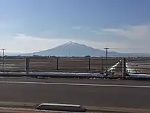
The Tsugaru Expressway (津軽自動車道, Tsugaru Jidōsha-dō) is a two-lane national expressway in Aomori Prefecture, Japan. The expressway connects the prefecture's capital, Aomori, and the Tōhoku Expressway to the municipalities of Goshogawara, Tsugaru and, Ajigasawa. It is owned and operated by Ministry of Land, Infrastructure, Transport and Tourism and is signed as an auxiliary route of National Route 101 as well as E64 under their "2016 Proposal for Realization of Expressway Numbering."[2][3]
Route description

The expressway's eastern terminus lies near the Namioka Interchange of the Tōhoku Expressway. A signaled intersection along National Route 7 separates the entrance to the Tōhoku Expressway from the Tsugaru Expressway. From this intersection, the expressway follows a northwestern heading out of the city limits of Aomori into Goshogawara. The expressway serves as a high-speed alternate to the main National Route 101 from National Route 7 to Goshogawara. When the expressway meets National Route 101, it instead serves as a bypass to the city, curving around heading north, west, and then south to meet its western terminus at another junction with National Route 101.
The speed limit is 70 km/h for the entire route; however, during the winter the speed limit is reduced to 60 km/h.[4]
Ajigasawa section
About 13 kilometers (8.1 mi) further west along National Route 101 in Ajigasawa, a 3.4 kilometres (2.1 mi) section of the expressway was partially completed in 2016 and expanded in 2019.[5] Its eastern end lies just outside of Ajigasawa in Tsugaru at an intersection with Route 101. The expressway segment has a single junction with Aomori Prefecture Route 31 and a crossing over the Narusawa River before it meets its end at Route 101 once more.[6]
History
On 8 August 1989, planning began on the route from the Namioka bypass to Goshogawawra. Construction began on the expressway in 1994. The first section of the expressway opened to traffic between Goshogawara-higashi and the Namioka bypass in 2002. Another section of the expressway opened to traffic between Goshogawara-higashi and Goshogawara-kita on 14 December 2007.[7] The third section of the expressway opened to traffic between Goshogawara-kita and Tsugaru Kashiwa on 3 November 2014. On 17 March 2015 the maximum speed was increased to 70 km/h. On 30 July 2016 the Ajigasawa section opened to traffic with a temporary at-grade junction with Melon Road.[1] This junction was replaced with a bridge on 26 March 2019 and the section was extended east to end at a junction with National Route 101.[8]
Future

The expressway is being widened within the city of Aomori from two lanes to four.
Plans are in progress for the construction of an expressway linking the Ajigasawa section to the rest of the Tsugaru Expressway along the 13-kilometer (8.1 mi) long gap. The route would parallel Route 101 from the north until just before the route would meet the Ajigasawa section where it would cross the road, paralleling it from the south. This expressway is planned to be extended south through Fukaura, Aomori to Happō in Akita Prefecture.[9]
Junction list
| Prefecture | Location | km | mi | Exit | Name | Destinations | Notes |
|---|---|---|---|---|---|---|---|
| Aomori | Aomori | 53 | Namioka | Under construction | |||
| 0 | 0.0 | — | Kosokudo | At-grade junction, current eastern terminus of the expressway | |||
| Goshogawara | 7.6 | 4.7 | — | Goshogawara-higashi | |||
| 11.4 | 7.1 | — | Goshogawara | Horogake Matsunoki Road – to Aomori Prefecture Route 156, Central Goshogawara, Kaneyama | |||
| 15.7 | 9.8 | — | Goshogawara-kita | ||||
| Tsugaru | 19.5 | 12.1 | — | Tsugaru Kashiwa | At-grade junction | ||
| 13 km gap in the expressway, connection is made by | |||||||
| Aomori | Tsugaru | 0 | 0.0 | — | Ukita[10] | At-grade junction, current eastern terminus of the expressway segment. | |
| Ajigasawa | 0.3 | 0.19 | — | (no name) | Melon Road | Closed at-grade junction, former eastern terminus of the expressway segment. | |
| 2.5 | 1.6 | — | Minami-Ukida | Aomori Prefecture Route 31 | |||
| 3.7 | 2.3 | — | Ajigasawa | At-grade junction, current western terminus of the expressway. | |||
| Akita | Happō | — | — | — | Proposed extension | ||
1.000 mi = 1.609 km; 1.000 km = 0.621 mi
| |||||||
See also
References
- 1 2 3 "津軽自動車道|青森県庁ウェブサイト Aomori Prefectural Government". www.pref.aomori.lg.jp.
- ↑ "Route 101". www.thr.mlit.go.jp/aomori.
- ↑ "Japan's Expressway Numbering System". www.mlit.go.jp.
- ↑ "Tsugaru Expressway's speed limit has changed from 60km/h to 70 km/h!". www.thr.mlit.go.jp.
- ↑ "E64 平成31年 3月14日 青森河川国道事務所 鰺ヶ沢道路 夜間通行止めのお知らせ" (PDF). Aomori Office of River and National Highway (in Japanese). 14 March 2019. Retrieved 12 September 2019.
- ↑ "Tsugaru Expressway Ajigasawa Road will open Saturday, July 30" (PDF). www.thr.mlit.go.jp. 13 July 2016. Retrieved 8 January 2018.
- ↑ "一般国道101号 浪岡五所川原道路" [General National Route 101 Namioka–Goshogawara Road] (PDF) (in Japanese). Ministry of Land, Infrastructure, Transport and Tourism. 4 July 2012. Retrieved 25 February 2021.
- ↑ "鰺ヶ沢道路 夜間通行止めのお知らせ" (PDF) (in Japanese). 14 March 2019. Retrieved 13 December 2019.
- ↑ "Tsugaru Expressway Kashiwa-Uchida Planning stage evaluation" (PDF). www.thr.mlit.go.jp.
- ↑ "Road Project Revaluation General Route No. 101 Ajigasawa Road" (PDF). www.thr.mlit.go.jp.