Brion | |
|---|---|
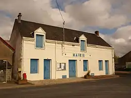 The town hall in Brion | |
Location of Brion | |
 Brion  Brion | |
| Coordinates: 46°57′28″N 1°43′42″E / 46.9578°N 1.7283°E | |
| Country | France |
| Region | Centre-Val de Loire |
| Department | Indre |
| Arrondissement | Châteauroux |
| Canton | Levroux |
| Government | |
| • Mayor (2020–2026) | Thierry Fourré[1] |
| Area 1 | 44.2 km2 (17.1 sq mi) |
| Population | 609 |
| • Density | 14/km2 (36/sq mi) |
| Time zone | UTC+01:00 (CET) |
| • Summer (DST) | UTC+02:00 (CEST) |
| INSEE/Postal code | 36026 /36110 |
| Elevation | 158–222 m (518–728 ft) (avg. 180 m or 590 ft) |
| 1 French Land Register data, which excludes lakes, ponds, glaciers > 1 km2 (0.386 sq mi or 247 acres) and river estuaries. | |
Brion (French pronunciation: [bʁijɔ̃] ⓘ) is a commune in the Indre department in central France.
Population
| Year | Pop. | ±% p.a. |
|---|---|---|
| 1968 | 680 | — |
| 1975 | 585 | −2.13% |
| 1982 | 598 | +0.31% |
| 1990 | 496 | −2.31% |
| 1999 | 440 | −1.32% |
| 2009 | 505 | +1.39% |
| 2014 | 530 | +0.97% |
| 2020 | 604 | +2.20% |
| Source: INSEE[3] | ||
See also
References
- ↑ "Répertoire national des élus: les maires". data.gouv.fr, Plateforme ouverte des données publiques françaises (in French). 2 December 2020.
- ↑ "Populations légales 2021". The National Institute of Statistics and Economic Studies. 28 December 2023.
- ↑ Population en historique depuis 1968, INSEE
Wikimedia Commons has media related to Brion (Indre).
This article is issued from Wikipedia. The text is licensed under Creative Commons - Attribution - Sharealike. Additional terms may apply for the media files.