Vineuil | |
|---|---|
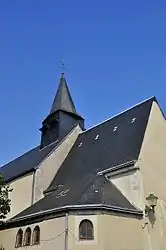 The church of Saint-Vincent, in Vineuil | |
Location of Vineuil | |
 Vineuil  Vineuil | |
| Coordinates: 46°54′05″N 1°38′10″E / 46.9014°N 1.6361°E | |
| Country | France |
| Region | Centre-Val de Loire |
| Department | Indre |
| Arrondissement | Châteauroux |
| Canton | Levroux |
| Government | |
| • Mayor (2020–2026) | Bernard Bachellerie[1] |
| Area 1 | 44.41 km2 (17.15 sq mi) |
| Population | 1,239 |
| • Density | 28/km2 (72/sq mi) |
| Time zone | UTC+01:00 (CET) |
| • Summer (DST) | UTC+02:00 (CEST) |
| INSEE/Postal code | 36247 /36110 |
| Elevation | 142–186 m (466–610 ft) (avg. 175 m or 574 ft) |
| 1 French Land Register data, which excludes lakes, ponds, glaciers > 1 km2 (0.386 sq mi or 247 acres) and river estuaries. | |
Vineuil (French pronunciation: [vinœj] ⓘ) is a commune in the Indre department, Centre-Val de Loire, France.[3]
Population
| Year | Pop. | ±% p.a. |
|---|---|---|
| 1968 | 807 | — |
| 1975 | 803 | −0.07% |
| 1982 | 977 | +2.84% |
| 1990 | 1,133 | +1.87% |
| 1999 | 1,139 | +0.06% |
| 2009 | 1,168 | +0.25% |
| 2014 | 1,225 | +0.96% |
| 2020 | 1,234 | +0.12% |
| Source: INSEE[4] | ||
See also
References
- ↑ "Répertoire national des élus: les maires" (in French). data.gouv.fr, Plateforme ouverte des données publiques françaises. 13 September 2022.
- ↑ "Populations légales 2021". The National Institute of Statistics and Economic Studies. 28 December 2023.
- ↑ INSEE commune file
- ↑ Population en historique depuis 1968, INSEE
Wikimedia Commons has media related to Vineuil (Indre).
This article is issued from Wikipedia. The text is licensed under Creative Commons - Attribution - Sharealike. Additional terms may apply for the media files.