La Buxerette | |
|---|---|
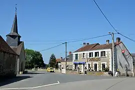 The church square in La Buxerette | |
Location of La Buxerette | |
 La Buxerette  La Buxerette | |
| Coordinates: 46°29′43″N 1°48′11″E / 46.4953°N 1.8031°E | |
| Country | France |
| Region | Centre-Val de Loire |
| Department | Indre |
| Arrondissement | La Châtre |
| Canton | Neuvy-Saint-Sépulchre |
| Intercommunality | Marche berrichonne |
| Government | |
| • Mayor (2021–2026) | Philippe Allely[1] |
| Area 1 | 10.99 km2 (4.24 sq mi) |
| Population | 119 |
| • Density | 11/km2 (28/sq mi) |
| Time zone | UTC+01:00 (CET) |
| • Summer (DST) | UTC+02:00 (CEST) |
| INSEE/Postal code | 36028 /36140 |
| Elevation | 282–387 m (925–1,270 ft) (avg. 372 m or 1,220 ft) |
| 1 French Land Register data, which excludes lakes, ponds, glaciers > 1 km2 (0.386 sq mi or 247 acres) and river estuaries. | |
La Buxerette is a commune in the Indre department in central France.
Geography
The Bouzanne forms the commune's western border.
Population
| Year | Pop. | ±% p.a. |
|---|---|---|
| 1968 | 270 | — |
| 1975 | 205 | −3.86% |
| 1982 | 183 | −1.61% |
| 1990 | 168 | −1.06% |
| 1999 | 128 | −2.98% |
| 2009 | 108 | −1.68% |
| 2014 | 103 | −0.94% |
| 2020 | 117 | +2.15% |
| Source: INSEE[3] | ||
See also
References
- ↑ "Répertoire national des élus: les maires". data.gouv.fr, Plateforme ouverte des données publiques françaises (in French). 9 August 2021.
- ↑ "Populations légales 2021". The National Institute of Statistics and Economic Studies. 28 December 2023.
- ↑ Population en historique depuis 1968, INSEE
Wikimedia Commons has media related to La Buxerette.
This article is issued from Wikipedia. The text is licensed under Creative Commons - Attribution - Sharealike. Additional terms may apply for the media files.