Gehée | |
|---|---|
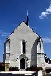 The church of Saint-Etienne, in Géhée | |
 Coat of arms | |
Location of Gehée | |
 Gehée  Gehée | |
| Coordinates: 47°02′51″N 1°30′10″E / 47.0475°N 1.5028°E | |
| Country | France |
| Region | Centre-Val de Loire |
| Department | Indre |
| Arrondissement | Châteauroux |
| Canton | Valençay |
| Government | |
| • Mayor (2020–2026) | Alain Reuillon[1] |
| Area 1 | 22.75 km2 (8.78 sq mi) |
| Population | 249 |
| • Density | 11/km2 (28/sq mi) |
| Time zone | UTC+01:00 (CET) |
| • Summer (DST) | UTC+02:00 (CEST) |
| INSEE/Postal code | 36082 /36240 |
| Elevation | 112–178 m (367–584 ft) (avg. 200 m or 660 ft) |
| 1 French Land Register data, which excludes lakes, ponds, glaciers > 1 km2 (0.386 sq mi or 247 acres) and river estuaries. | |
Gehée (French pronunciation: [ʒə.e]) is a commune in the Indre department in central France.
Population
| Year | Pop. | ±% p.a. |
|---|---|---|
| 1968 | 480 | — |
| 1975 | 439 | −1.27% |
| 1982 | 352 | −3.11% |
| 1990 | 313 | −1.46% |
| 1999 | 301 | −0.43% |
| 2009 | 282 | −0.65% |
| 2014 | 261 | −1.54% |
| 2020 | 250 | −0.72% |
| Source: INSEE[3] | ||
See also
References
- ↑ "Répertoire national des élus: les maires". data.gouv.fr, Plateforme ouverte des données publiques françaises (in French). 2 December 2020.
- ↑ "Populations légales 2021". The National Institute of Statistics and Economic Studies. 28 December 2023.
- ↑ Population en historique depuis 1968, INSEE
Wikimedia Commons has media related to Gehée.
This article is issued from Wikipedia. The text is licensed under Creative Commons - Attribution - Sharealike. Additional terms may apply for the media files.