Palluau-sur-Indre | |
|---|---|
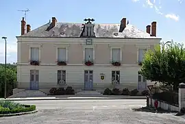 Town hall | |
.svg.png.webp) Coat of arms | |
Location of Palluau-sur-Indre | |
 Palluau-sur-Indre  Palluau-sur-Indre | |
| Coordinates: 46°56′41″N 1°18′45″E / 46.9447°N 1.3125°E | |
| Country | France |
| Region | Centre-Val de Loire |
| Department | Indre |
| Arrondissement | Châteauroux |
| Canton | Buzançais |
| Government | |
| • Mayor (2020–2026) | Marc Rouffy[1] |
| Area 1 | 41.55 km2 (16.04 sq mi) |
| Population | 794 |
| • Density | 19/km2 (49/sq mi) |
| Time zone | UTC+01:00 (CET) |
| • Summer (DST) | UTC+02:00 (CEST) |
| INSEE/Postal code | 36149 /36500 |
| Elevation | 91–196 m (299–643 ft) (avg. 177 m or 581 ft) |
| 1 French Land Register data, which excludes lakes, ponds, glaciers > 1 km2 (0.386 sq mi or 247 acres) and river estuaries. | |
Palluau-sur-Indre (French pronunciation: [palɥo syʁ ɛ̃dʁ], literally Palluau upon Indre) is a commune in the Indre department in central France.
Population
| Year | Pop. | ±% p.a. |
|---|---|---|
| 1968 | 1,154 | — |
| 1975 | 1,028 | −1.64% |
| 1982 | 1,017 | −0.15% |
| 1990 | 905 | −1.45% |
| 1999 | 828 | −0.98% |
| 2009 | 783 | −0.56% |
| 2014 | 763 | −0.52% |
| 2020 | 798 | +0.75% |
| Source: INSEE[3] | ||
See also
References
- ↑ "Répertoire national des élus: les maires" (in French). data.gouv.fr, Plateforme ouverte des données publiques françaises. 13 September 2022.
- ↑ "Populations légales 2021". The National Institute of Statistics and Economic Studies. 28 December 2023.
- ↑ Population en historique depuis 1968, INSEE
Wikimedia Commons has media related to Palluau-sur-Indre.
This article is issued from Wikipedia. The text is licensed under Creative Commons - Attribution - Sharealike. Additional terms may apply for the media files.