Saint-Lactencin | |
|---|---|
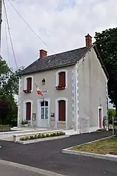 The town hall in Saint-Lactencin | |
Location of Saint-Lactencin | |
 Saint-Lactencin  Saint-Lactencin | |
| Coordinates: 46°53′56″N 1°29′38″E / 46.8989°N 1.4939°E | |
| Country | France |
| Region | Centre-Val de Loire |
| Department | Indre |
| Arrondissement | Châteauroux |
| Canton | Buzançais |
| Intercommunality | Val de l'Indre-Brenne |
| Government | |
| • Mayor (2020–2026) | Thierry Logie[1] |
| Area 1 | 32.2 km2 (12.4 sq mi) |
| Population | 402 |
| • Density | 12/km2 (32/sq mi) |
| Time zone | UTC+01:00 (CET) |
| • Summer (DST) | UTC+02:00 (CEST) |
| INSEE/Postal code | 36198 /36500 |
| Elevation | 116–182 m (381–597 ft) (avg. 150 m or 490 ft) |
| 1 French Land Register data, which excludes lakes, ponds, glaciers > 1 km2 (0.386 sq mi or 247 acres) and river estuaries. | |
Saint-Lactencin (French pronunciation: [sɛ̃ laktɑ̃sɛ̃]) is a commune in the Indre department, central France.
Population
| Year | Pop. | ±% p.a. |
|---|---|---|
| 1968 | 389 | — |
| 1975 | 367 | −0.83% |
| 1982 | 366 | −0.04% |
| 1990 | 409 | +1.40% |
| 1999 | 353 | −1.62% |
| 2009 | 402 | +1.31% |
| 2014 | 429 | +1.31% |
| 2020 | 403 | −1.04% |
| Source: INSEE[3] | ||
See also
References
- ↑ "Répertoire national des élus: les maires". data.gouv.fr, Plateforme ouverte des données publiques françaises (in French). 9 August 2021.
- ↑ "Populations légales 2021". The National Institute of Statistics and Economic Studies. 28 December 2023.
- ↑ Population en historique depuis 1968, INSEE
Wikimedia Commons has media related to Saint-Lactencin.
This article is issued from Wikipedia. The text is licensed under Creative Commons - Attribution - Sharealike. Additional terms may apply for the media files.