Heugnes | |
|---|---|
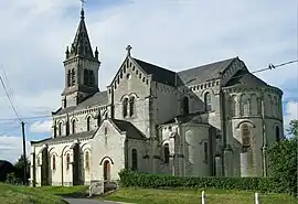 The church of Saint-Martin, in Heugnes | |
.svg.png.webp) Coat of arms | |
Location of Heugnes | |
 Heugnes  Heugnes | |
| Coordinates: 47°00′46″N 1°24′34″E / 47.0128°N 1.4094°E | |
| Country | France |
| Region | Centre-Val de Loire |
| Department | Indre |
| Arrondissement | Châteauroux |
| Canton | Valençay |
| Government | |
| • Mayor (2020–2026) | Philippe Kocher[1] |
| Area 1 | 42.17 km2 (16.28 sq mi) |
| Population | 389 |
| • Density | 9.2/km2 (24/sq mi) |
| Time zone | UTC+01:00 (CET) |
| • Summer (DST) | UTC+02:00 (CEST) |
| INSEE/Postal code | 36086 /36180 |
| Elevation | 133–201 m (436–659 ft) (avg. 190 m or 620 ft) |
| 1 French Land Register data, which excludes lakes, ponds, glaciers > 1 km2 (0.386 sq mi or 247 acres) and river estuaries. | |
Heugnes (French pronunciation: [œɲ]) is a commune in the Indre department in central France.
Population
| Year | Pop. | ±% p.a. |
|---|---|---|
| 1968 | 562 | — |
| 1975 | 466 | −2.64% |
| 1982 | 423 | −1.37% |
| 1990 | 399 | −0.73% |
| 1999 | 436 | +0.99% |
| 2009 | 398 | −0.91% |
| 2014 | 406 | +0.40% |
| 2020 | 389 | −0.71% |
| Source: INSEE[3] | ||
See also
References
- ↑ "Répertoire national des élus: les maires" (in French). data.gouv.fr, Plateforme ouverte des données publiques françaises. 13 September 2022.
- ↑ "Populations légales 2021". The National Institute of Statistics and Economic Studies. 28 December 2023.
- ↑ Population en historique depuis 1968, INSEE
Wikimedia Commons has media related to Heugnes.
This article is issued from Wikipedia. The text is licensed under Creative Commons - Attribution - Sharealike. Additional terms may apply for the media files.