Champillet | |
|---|---|
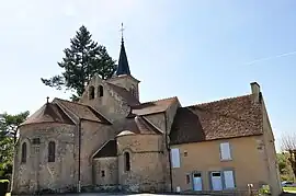 The Church of Saint-Pierre and the town hall, in Champillet | |
Location of Champillet | |
 Champillet  Champillet | |
| Coordinates: 46°32′55″N 2°06′53″E / 46.5486°N 2.1147°E | |
| Country | France |
| Region | Centre-Val de Loire |
| Department | Indre |
| Arrondissement | La Châtre |
| Canton | La Châtre |
| Intercommunality | La Châtre et Sainte-Sévère |
| Government | |
| • Mayor (2020–2026) | Michel Salmon[1] |
| Area 1 | 6.94 km2 (2.68 sq mi) |
| Population | 129 |
| • Density | 19/km2 (48/sq mi) |
| Time zone | UTC+01:00 (CET) |
| • Summer (DST) | UTC+02:00 (CEST) |
| INSEE/Postal code | 36038 /36160 |
| Elevation | 224–289 m (735–948 ft) (avg. 250 m or 820 ft) |
| 1 French Land Register data, which excludes lakes, ponds, glaciers > 1 km2 (0.386 sq mi or 247 acres) and river estuaries. | |
Champillet (French pronunciation: [ʃɑ̃pijɛ]) is a commune in the Indre department in central France.
Population
| Year | Pop. | ±% p.a. |
|---|---|---|
| 1968 | 190 | — |
| 1975 | 173 | −1.33% |
| 1982 | 168 | −0.42% |
| 1990 | 144 | −1.91% |
| 1999 | 154 | +0.75% |
| 2009 | 157 | +0.19% |
| 2014 | 156 | −0.13% |
| 2020 | 133 | −2.62% |
| Source: INSEE[3] | ||
See also
References
- ↑ "Répertoire national des élus: les maires" (in French). data.gouv.fr, Plateforme ouverte des données publiques françaises. 13 September 2022.
- ↑ "Populations légales 2021". The National Institute of Statistics and Economic Studies. 28 December 2023.
- ↑ Population en historique depuis 1968, INSEE
Wikimedia Commons has media related to Champillet.
This article is issued from Wikipedia. The text is licensed under Creative Commons - Attribution - Sharealike. Additional terms may apply for the media files.