Bantigny | |
|---|---|
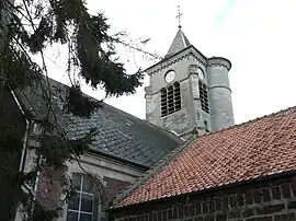 The church in Bantigny | |
_Nord-France.svg.png.webp) Coat of arms | |
Location of Bantigny | |
 Bantigny  Bantigny | |
| Coordinates: 50°13′48″N 3°13′51″E / 50.23°N 3.2308°E | |
| Country | France |
| Region | Hauts-de-France |
| Department | Nord |
| Arrondissement | Cambrai |
| Canton | Cambrai |
| Intercommunality | CA Cambrai |
| Government | |
| • Mayor (2020–2026) | Yves Marécaille[1] |
| Area 1 | 3.17 km2 (1.22 sq mi) |
| Population | 507 |
| • Density | 160/km2 (410/sq mi) |
| Time zone | UTC+01:00 (CET) |
| • Summer (DST) | UTC+02:00 (CEST) |
| INSEE/Postal code | 59048 /59554 |
| Elevation | 39–65 m (128–213 ft) (avg. 48 m or 157 ft) |
| 1 French Land Register data, which excludes lakes, ponds, glaciers > 1 km2 (0.386 sq mi or 247 acres) and river estuaries. | |
Bantigny (French pronunciation: [bɑ̃tiɲi]) is a commune in the Nord department in northern France.[3]
Population
| Year | Pop. | ±% p.a. |
|---|---|---|
| 1968 | 264 | — |
| 1975 | 250 | −0.78% |
| 1982 | 440 | +8.41% |
| 1990 | 477 | +1.01% |
| 1999 | 465 | −0.28% |
| 2009 | 463 | −0.04% |
| 2014 | 496 | +1.39% |
| 2020 | 515 | +0.63% |
| Source: INSEE[4] | ||
Heraldry
Arms of Bantigny |
The arms of Bantigny are blazoned : Gules, on a bend argent, 3 martlets sable.
|
See also
References
- ↑ "Répertoire national des élus: les maires" (in French). data.gouv.fr, Plateforme ouverte des données publiques françaises. 13 September 2022.
- ↑ "Populations légales 2021". The National Institute of Statistics and Economic Studies. 28 December 2023.
- ↑ INSEE commune file
- ↑ Population en historique depuis 1968, INSEE
Wikimedia Commons has media related to Bantigny.
This article is issued from Wikipedia. The text is licensed under Creative Commons - Attribution - Sharealike. Additional terms may apply for the media files.