Raillencourt-Sainte-Olle | |
|---|---|
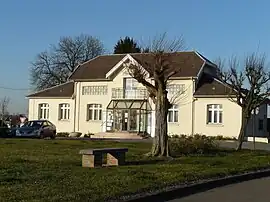 The town hall in Raillencourt-Sainte-Olle | |
_Nord-France.svg.png.webp) Coat of arms | |
Location of Raillencourt-Sainte-Olle | |
 Raillencourt-Sainte-Olle  Raillencourt-Sainte-Olle | |
| Coordinates: 50°11′33″N 3°10′09″E / 50.1925°N 3.1692°E | |
| Country | France |
| Region | Hauts-de-France |
| Department | Nord |
| Arrondissement | Cambrai |
| Canton | Cambrai |
| Intercommunality | CA Cambrai |
| Government | |
| • Mayor (2020–2026) | Bernard De Narda[1] |
| Area 1 | 7.09 km2 (2.74 sq mi) |
| Population | 2,128 |
| • Density | 300/km2 (780/sq mi) |
| Time zone | UTC+01:00 (CET) |
| • Summer (DST) | UTC+02:00 (CEST) |
| INSEE/Postal code | 59488 /59554 |
| Elevation | 45–86 m (148–282 ft) (avg. 63 m or 207 ft) |
| 1 French Land Register data, which excludes lakes, ponds, glaciers > 1 km2 (0.386 sq mi or 247 acres) and river estuaries. | |
Raillencourt-Sainte-Olle (French pronunciation: [ʁajɑ̃kuʁ sɛ̃t ɔl]) is a commune in the Nord department in northern France.[3]
Population
| Year | Pop. | ±% p.a. |
|---|---|---|
| 1968 | 1,891 | — |
| 1975 | 1,826 | −0.50% |
| 1982 | 2,201 | +2.70% |
| 1990 | 2,220 | +0.11% |
| 1999 | 2,280 | +0.30% |
| 2007 | 2,378 | +0.53% |
| 2012 | 2,347 | −0.26% |
| 2017 | 2,238 | −0.95% |
| Source: INSEE[4] | ||
Heraldry
Arms of Raillencourt-Sainte-Olle |
The arms of Raillencourt-Sainte-Olle are blazoned : Gules, 3 fesses Or, a bordure argent.
|
See also
References
- ↑ "Répertoire national des élus: les maires" (in French). data.gouv.fr, Plateforme ouverte des données publiques françaises. 13 September 2022.
- ↑ "Populations légales 2021". The National Institute of Statistics and Economic Studies. 28 December 2023.
- ↑ INSEE commune file
- ↑ Population en historique depuis 1968, INSEE
Wikimedia Commons has media related to Raillencourt-Sainte-Olle.
This article is issued from Wikipedia. The text is licensed under Creative Commons - Attribution - Sharealike. Additional terms may apply for the media files.