Gonnelieu | |
|---|---|
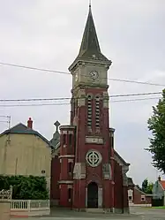 The church in Gonnelieu | |
_nord-france.svg.png.webp) Coat of arms | |
Location of Gonnelieu | |
 Gonnelieu  Gonnelieu | |
| Coordinates: 50°03′31″N 3°09′14″E / 50.0586°N 3.1539°E | |
| Country | France |
| Region | Hauts-de-France |
| Department | Nord |
| Arrondissement | Cambrai |
| Canton | Le Cateau-Cambrésis |
| Intercommunality | CA Cambrai |
| Government | |
| • Mayor (2020–2026) | Karine Morelle[1] |
| Area 1 | 4.97 km2 (1.92 sq mi) |
| Population | 289 |
| • Density | 58/km2 (150/sq mi) |
| Time zone | UTC+01:00 (CET) |
| • Summer (DST) | UTC+02:00 (CEST) |
| INSEE/Postal code | 59267 /59231 |
| Elevation | 89–137 m (292–449 ft) |
| 1 French Land Register data, which excludes lakes, ponds, glaciers > 1 km2 (0.386 sq mi or 247 acres) and river estuaries. | |
Gonnelieu (French pronunciation: [ɡɔnəljø]) is a commune in the Nord department in northern France.[3]
History
During World War I, the town was captured by the German Empire during the Battle of Cambrai in 1917.[4]
Heraldry
Arms of Gonnelieu |
The arms of Gonnelieu are blazoned : Or, a bend sable. (Flesquières, Gonnelieu, Mons-en-Barœul and Viesly use the same arms.)
|
See also
References
- ↑ "Répertoire national des élus: les maires" (in French). data.gouv.fr, Plateforme ouverte des données publiques françaises. 13 September 2022.
- ↑ "Populations légales 2021". The National Institute of Statistics and Economic Studies. 28 December 2023.
- ↑ INSEE commune file
- ↑ Murland, Jerry (2022). The Battle of Cambrai 1917: Mœuvres and Bourlon, Cantaing and Graincourt to Flesquières, Masnières, Gouzeaucourt and Gonnelieu. Pen and Sword Military. ISBN 9781399017466.
Wikimedia Commons has media related to Gonnelieu.
This article is issued from Wikipedia. The text is licensed under Creative Commons - Attribution - Sharealike. Additional terms may apply for the media files.