Roost-Warendin | |
|---|---|
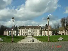 Château de Bernicourt | |
_Nord-France.svg.png.webp) Coat of arms | |
Location of Roost-Warendin | |
 Roost-Warendin  Roost-Warendin | |
| Coordinates: 50°25′16″N 3°06′22″E / 50.421°N 3.106°E | |
| Country | France |
| Region | Hauts-de-France |
| Department | Nord |
| Arrondissement | Douai |
| Canton | Orchies |
| Intercommunality | Douaisis Agglo |
| Government | |
| • Mayor (2020–2026) | Lionel Courdavault[1] |
| Area 1 | 7.16 km2 (2.76 sq mi) |
| Population | 5,976 |
| • Density | 830/km2 (2,200/sq mi) |
| Time zone | UTC+01:00 (CET) |
| • Summer (DST) | UTC+02:00 (CEST) |
| INSEE/Postal code | 59509 /59286 |
| Elevation | 18–27 m (59–89 ft) (avg. 21 m or 69 ft) |
| 1 French Land Register data, which excludes lakes, ponds, glaciers > 1 km2 (0.386 sq mi or 247 acres) and river estuaries. | |
Roost-Warendin (French pronunciation: [ʁo vaʁɑ̃dɛ̃]) is a commune in the Nord department in northern France.[3]
Population
| Year | Pop. | ±% p.a. |
|---|---|---|
| 1968 | 6,292 | — |
| 1975 | 6,356 | +0.14% |
| 1982 | 6,439 | +0.19% |
| 1990 | 6,413 | −0.05% |
| 1999 | 5,744 | −1.22% |
| 2007 | 6,157 | +0.87% |
| 2012 | 6,178 | +0.07% |
| 2017 | 6,141 | −0.12% |
| Source: INSEE[4] | ||
Twin towns
Roost-Warendin is twinned with:
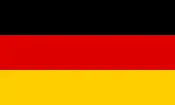 Haltern am See, Germany
Heraldry
Arms of Roost-Warendin |
The arms of Roost-Warendin are blazoned : Sable semy de lys Or.
|
See also
References
- ↑ "Répertoire national des élus: les maires". data.gouv.fr, Plateforme ouverte des données publiques françaises (in French). 2 December 2020.
- ↑ "Populations légales 2021". The National Institute of Statistics and Economic Studies. 28 December 2023.
- ↑ INSEE commune file
- ↑ Population en historique depuis 1968, INSEE
Wikimedia Commons has media related to Roost-Warendin.
This article is issued from Wikipedia. The text is licensed under Creative Commons - Attribution - Sharealike. Additional terms may apply for the media files.