Lallaing | |
|---|---|
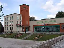 The town hall in Lallaing | |
.svg.png.webp) Coat of arms | |
Location of Lallaing | |
 Lallaing  Lallaing | |
| Coordinates: 50°23′24″N 3°10′08″E / 50.390°N 3.169°E | |
| Country | France |
| Region | Hauts-de-France |
| Department | Nord |
| Arrondissement | Douai |
| Canton | Sin-le-Noble |
| Intercommunality | Douaisis Agglo |
| Government | |
| • Mayor (2020–2026) | Jean-Paul Fontaine[1] |
| Area 1 | 5.99 km2 (2.31 sq mi) |
| Population | 6,250 |
| • Density | 1,000/km2 (2,700/sq mi) |
| Time zone | UTC+01:00 (CET) |
| • Summer (DST) | UTC+02:00 (CEST) |
| INSEE/Postal code | 59327 /59167 |
| Elevation | 16–30 m (52–98 ft) (avg. 20 m or 66 ft) |
| 1 French Land Register data, which excludes lakes, ponds, glaciers > 1 km2 (0.386 sq mi or 247 acres) and river estuaries. | |
Lallaing (French pronunciation: [lalɛ̃]) is a commune in the Nord department in northern France.[3]
Population
| Year | Pop. | ±% p.a. |
|---|---|---|
| 1968 | 8,813 | — |
| 1975 | 8,399 | −0.69% |
| 1982 | 8,174 | −0.39% |
| 1990 | 8,001 | −0.27% |
| 1999 | 6,999 | −1.48% |
| 2007 | 6,533 | −0.86% |
| 2012 | 6,405 | −0.39% |
| 2017 | 6,231 | −0.55% |
| Source: INSEE[4] | ||
Heraldry
Arms of Lallaing |
The arms of Lallaing are blazoned: Gules, 10 lozenges conjoined argent 3,3,3 and 1. (Fressain, Hergnies, Lallaing and Marpent use the same arms.)
|
See also
References
- ↑ "Répertoire national des élus: les maires". data.gouv.fr, Plateforme ouverte des données publiques françaises (in French). 2 December 2020.
- ↑ "Populations légales 2021". The National Institute of Statistics and Economic Studies. 28 December 2023.
- ↑ INSEE commune file
- ↑ Population en historique depuis 1968, INSEE
External links
 Media related to Lallaing at Wikimedia Commons
This article is issued from Wikipedia. The text is licensed under Creative Commons - Attribution - Sharealike. Additional terms may apply for the media files.