Taisnières-en-Thiérache | |
|---|---|
_mairie_et_tour_de_l'eglise.jpg.webp) The town hall in Taisnières-en-Thiérache | |
 Coat of arms | |
Location of Taisnières-en-Thiérache | |
 Taisnières-en-Thiérache  Taisnières-en-Thiérache | |
| Coordinates: 50°08′48″N 3°48′51″E / 50.1467°N 3.8142°E | |
| Country | France |
| Region | Hauts-de-France |
| Department | Nord |
| Arrondissement | Avesnes-sur-Helpe |
| Canton | Avesnes-sur-Helpe |
| Intercommunality | CC Cœur de l'Avesnois |
| Government | |
| • Mayor (2020–2026) | Claude Connart[1] |
| Area 1 | 8.5 km2 (3.3 sq mi) |
| Population | 476 |
| • Density | 56/km2 (150/sq mi) |
| Time zone | UTC+01:00 (CET) |
| • Summer (DST) | UTC+02:00 (CEST) |
| INSEE/Postal code | 59583 /59550 |
| Elevation | 131–191 m (430–627 ft) (avg. 140 m or 460 ft) |
| 1 French Land Register data, which excludes lakes, ponds, glaciers > 1 km2 (0.386 sq mi or 247 acres) and river estuaries. | |
Taisnières-en-Thiérache (French pronunciation: [tɛnjɛʁ ɑ̃ tjeʁaʃ], literally Taisnières in Thiérache) is a commune in the Nord department in northern France.[3]
Heraldry
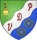
Arms of Taisnières-en-Thiérache |
The arms of Taisnières-en-Thiérache are blazoned : Per bend sinister vert and azure, on a bend sinister wavy argent between a bell tranfixed by a crozier and in base 2 wheels Or, the letters P,D and V gules.
|
See also
References
- ↑ "Répertoire national des élus: les maires" (in French). data.gouv.fr, Plateforme ouverte des données publiques françaises. 13 September 2022.
- ↑ "Populations légales 2021". The National Institute of Statistics and Economic Studies. 28 December 2023.
- ↑ INSEE commune file
Wikimedia Commons has media related to Taisnières-en-Thiérache.
This article is issued from Wikipedia. The text is licensed under Creative Commons - Attribution - Sharealike. Additional terms may apply for the media files.