Villers-Guislain | |
|---|---|
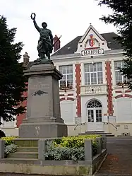 The town hall in Villers-Guislain | |
_1.svg.png.webp) Coat of arms | |
Location of Villers-Guislain | |
 Villers-Guislain  Villers-Guislain | |
| Coordinates: 50°02′27″N 3°09′23″E / 50.0408°N 3.1564°E | |
| Country | France |
| Region | Hauts-de-France |
| Department | Nord |
| Arrondissement | Cambrai |
| Canton | Le Cateau-Cambrésis |
| Intercommunality | CA Cambrai |
| Government | |
| • Mayor (2020–2026) | Gérard Allart[1] |
| Area 1 | 11.27 km2 (4.35 sq mi) |
| Population | 680 |
| • Density | 60/km2 (160/sq mi) |
| Time zone | UTC+01:00 (CET) |
| • Summer (DST) | UTC+02:00 (CEST) |
| INSEE/Postal code | 59623 /59297 |
| Elevation | 86–141 m (282–463 ft) (avg. 136 m or 446 ft) |
| 1 French Land Register data, which excludes lakes, ponds, glaciers > 1 km2 (0.386 sq mi or 247 acres) and river estuaries. | |
Villers-Guislain (French pronunciation: [vilɛʁ ɡilɛ̃]) is a commune in the Nord department in northern France.[3] The graveyard at Gauche Wood contains the casualties who died during the Battle of Épehy when British troops were deployed between Gouzeaucourt and Villers-Guislain.
Heraldry
Arms of Villers-Guislain |
The arms of Villers-Guislain are blazoned : Tierced per pale 1: Azure, a ?fleur de? lys argent; 2: Gules, a demi- doubleheaded eagle and a demi-cross potenty argent, both issuant from the dexter line of division; 3: Or, 3 fesses azure.
|
See also
References
- ↑ "Répertoire national des élus: les maires" (in French). data.gouv.fr, Plateforme ouverte des données publiques françaises. 13 September 2022.
- ↑ "Populations légales 2021". The National Institute of Statistics and Economic Studies. 28 December 2023.
- ↑ INSEE commune file
Wikimedia Commons has media related to Villers-Guislain.
This article is issued from Wikipedia. The text is licensed under Creative Commons - Attribution - Sharealike. Additional terms may apply for the media files.