La Chapelle-au-Mans | |
|---|---|
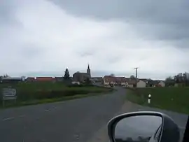 A general view of La Chapelle-au-Mans | |
Location of La Chapelle-au-Mans | |
 La Chapelle-au-Mans  La Chapelle-au-Mans | |
| Coordinates: 46°37′38″N 3°58′22″E / 46.6272°N 3.9728°E | |
| Country | France |
| Region | Bourgogne-Franche-Comté |
| Department | Saône-et-Loire |
| Arrondissement | Charolles |
| Canton | Gueugnon |
| Intercommunality | Entre Arroux, Loire et Somme |
| Government | |
| • Mayor (2020–2026) | Armelle Devillard[1] |
| Area 1 | 27.5 km2 (10.6 sq mi) |
| Population | 221 |
| • Density | 8.0/km2 (21/sq mi) |
| Time zone | UTC+01:00 (CET) |
| • Summer (DST) | UTC+02:00 (CEST) |
| INSEE/Postal code | 71088 /71130 |
| Elevation | 255–401 m (837–1,316 ft) (avg. 374 m or 1,227 ft) |
| 1 French Land Register data, which excludes lakes, ponds, glaciers > 1 km2 (0.386 sq mi or 247 acres) and river estuaries. | |
La Chapelle-au-Mans (French pronunciation: [la ʃapɛl o mɑ̃]) is a commune in the Saône-et-Loire department in the region of Bourgogne-Franche-Comté in eastern France.
See also
References
- ↑ "Répertoire national des élus: les maires" (in French). data.gouv.fr, Plateforme ouverte des données publiques françaises. 13 September 2022.
- ↑ "Populations légales 2021". The National Institute of Statistics and Economic Studies. 28 December 2023.
Wikimedia Commons has media related to La Chapelle-au-Mans.
This article is issued from Wikipedia. The text is licensed under Creative Commons - Attribution - Sharealike. Additional terms may apply for the media files.