Saint-Gervais-sur-Couches | |
|---|---|
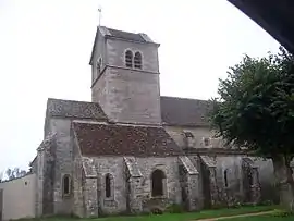 The church in Saint-Gervais-sur-Couches | |
Location of Saint-Gervais-sur-Couches | |
 Saint-Gervais-sur-Couches  Saint-Gervais-sur-Couches | |
| Coordinates: 46°55′16″N 4°35′05″E / 46.9211°N 4.5847°E | |
| Country | France |
| Region | Bourgogne-Franche-Comté |
| Department | Saône-et-Loire |
| Arrondissement | Autun |
| Canton | Autun-1 |
| Area 1 | 20.47 km2 (7.90 sq mi) |
| Population | 213 |
| • Density | 10/km2 (27/sq mi) |
| Time zone | UTC+01:00 (CET) |
| • Summer (DST) | UTC+02:00 (CEST) |
| INSEE/Postal code | 71424 /71490 |
| Elevation | 367–510 m (1,204–1,673 ft) (avg. 486 m or 1,594 ft) |
| 1 French Land Register data, which excludes lakes, ponds, glaciers > 1 km2 (0.386 sq mi or 247 acres) and river estuaries. | |
Saint-Gervais-sur-Couches (French pronunciation: [sɛ̃ ʒɛʁvɛ syʁ kuʃ], literally Saint-Gervais on Couches) is a commune in the Saône-et-Loire department in the region of Bourgogne-Franche-Comté in eastern France.
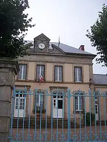
Town hall
See also
References
- ↑ "Populations légales 2021". The National Institute of Statistics and Economic Studies. 28 December 2023.
Wikimedia Commons has media related to Saint-Gervais-sur-Couches.
This article is issued from Wikipedia. The text is licensed under Creative Commons - Attribution - Sharealike. Additional terms may apply for the media files.