Saint-Didier-en-Brionnais | |
|---|---|
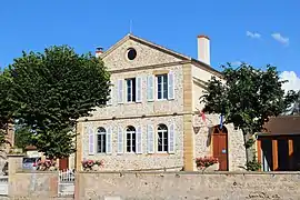 The town hall in Saint-Didier-en-Brionnais | |
Location of Saint-Didier-en-Brionnais | |
 Saint-Didier-en-Brionnais  Saint-Didier-en-Brionnais | |
| Coordinates: 46°20′15″N 4°07′36″E / 46.3375°N 4.1267°E | |
| Country | France |
| Region | Bourgogne-Franche-Comté |
| Department | Saône-et-Loire |
| Arrondissement | Charolles |
| Canton | Chauffailles |
| Government | |
| • Mayor (2020–2026) | René Sarroca[1] |
| Area 1 | 11.34 km2 (4.38 sq mi) |
| Population | 123 |
| • Density | 11/km2 (28/sq mi) |
| Time zone | UTC+01:00 (CET) |
| • Summer (DST) | UTC+02:00 (CEST) |
| INSEE/Postal code | 71406 /71110 |
| Elevation | 254–348 m (833–1,142 ft) (avg. 220 m or 720 ft) |
| 1 French Land Register data, which excludes lakes, ponds, glaciers > 1 km2 (0.386 sq mi or 247 acres) and river estuaries. | |
Saint-Didier-en-Brionnais (French pronunciation: [sɛ̃ didje ɑ̃ bʁijɔnɛ]) is a commune in the Saône-et-Loire department in the region of Bourgogne-Franche-Comté in eastern France.
Geography
The Arconce flows southwestward through the middle of the commune.
See also
References
- ↑ "Répertoire national des élus: les maires". data.gouv.fr, Plateforme ouverte des données publiques françaises (in French). 2 December 2020.
- ↑ "Populations légales 2021". The National Institute of Statistics and Economic Studies. 28 December 2023.
Wikimedia Commons has media related to Saint-Didier-en-Brionnais.
This article is issued from Wikipedia. The text is licensed under Creative Commons - Attribution - Sharealike. Additional terms may apply for the media files.