Saint-Romain-sous-Gourdon | |
|---|---|
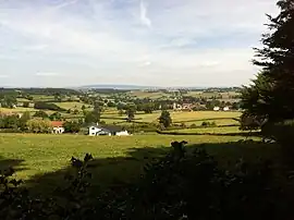 A general view of Saint-Romain-sous-Gourdon | |
Location of Saint-Romain-sous-Gourdon | |
 Saint-Romain-sous-Gourdon  Saint-Romain-sous-Gourdon | |
| Coordinates: 46°37′22″N 4°24′16″E / 46.6228°N 4.4044°E | |
| Country | France |
| Region | Bourgogne-Franche-Comté |
| Department | Saône-et-Loire |
| Arrondissement | Autun |
| Canton | Charolles |
| Intercommunality | CU Creusot Montceau |
| Area 1 | 18.78 km2 (7.25 sq mi) |
| Population | 486 |
| • Density | 26/km2 (67/sq mi) |
| Time zone | UTC+01:00 (CET) |
| • Summer (DST) | UTC+02:00 (CEST) |
| INSEE/Postal code | 71477 /71230 |
| Elevation | 301–467 m (988–1,532 ft) |
| 1 French Land Register data, which excludes lakes, ponds, glaciers > 1 km2 (0.386 sq mi or 247 acres) and river estuaries. | |
Saint-Romain-sous-Gourdon (French pronunciation: [sɛ̃ ʁɔmɛ̃ su ɡuʁdɔ̃], literally Saint-Romain under Gourdon) is a commune in the Saône-et-Loire department in the region of Bourgogne-Franche-Comté in eastern France.
It is 45 km south west of Chalon-sur-Saône, 25 km due south of Le Creusot and 6 km south east of Montceau-les-Mines.
See also
References
- ↑ "Populations légales 2021". The National Institute of Statistics and Economic Studies. 28 December 2023.
Wikimedia Commons has media related to Saint-Romain-sous-Gourdon.
This article is issued from Wikipedia. The text is licensed under Creative Commons - Attribution - Sharealike. Additional terms may apply for the media files.