La Chapelle-sous-Dun | |
|---|---|
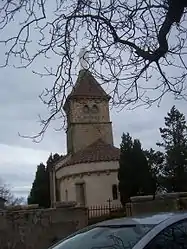 The church in La Chapelle-sous-Dun | |
Location of La Chapelle-sous-Dun | |
 La Chapelle-sous-Dun  La Chapelle-sous-Dun | |
| Coordinates: 46°15′39″N 4°17′38″E / 46.2608°N 4.2939°E | |
| Country | France |
| Region | Bourgogne-Franche-Comté |
| Department | Saône-et-Loire |
| Arrondissement | Charolles |
| Canton | Chauffailles |
| Area 1 | 8.51 km2 (3.29 sq mi) |
| Population | 433 |
| • Density | 51/km2 (130/sq mi) |
| Time zone | UTC+01:00 (CET) |
| • Summer (DST) | UTC+02:00 (CEST) |
| INSEE/Postal code | 71095 /71800 |
| Elevation | 317–553 m (1,040–1,814 ft) (avg. 350 m or 1,150 ft) |
| 1 French Land Register data, which excludes lakes, ponds, glaciers > 1 km2 (0.386 sq mi or 247 acres) and river estuaries. | |
La Chapelle-sous-Dun (French pronunciation: [la ʃapɛl su dœ̃]) is a commune in the Saône-et-Loire department in the region of Bourgogne-Franche-Comté in eastern France.
See also
References
- ↑ "Populations légales 2021". The National Institute of Statistics and Economic Studies. 28 December 2023.
Wikimedia Commons has media related to La Chapelle-sous-Dun.
This article is issued from Wikipedia. The text is licensed under Creative Commons - Attribution - Sharealike. Additional terms may apply for the media files.