Laives | |
|---|---|
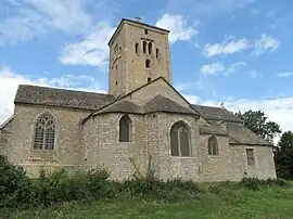 The church of Saint-Martin in Laives | |
Location of Laives | |
 Laives  Laives | |
| Coordinates: 46°38′46″N 4°50′47″E / 46.6461°N 4.8464°E | |
| Country | France |
| Region | Bourgogne-Franche-Comté |
| Department | Saône-et-Loire |
| Arrondissement | Chalon-sur-Saône |
| Canton | Tournus |
| Area 1 | 12.62 km2 (4.87 sq mi) |
| Population | 973 |
| • Density | 77/km2 (200/sq mi) |
| Time zone | UTC+01:00 (CET) |
| • Summer (DST) | UTC+02:00 (CEST) |
| INSEE/Postal code | 71249 /71240 |
| Elevation | 177–331 m (581–1,086 ft) (avg. 198 m or 650 ft) |
| 1 French Land Register data, which excludes lakes, ponds, glaciers > 1 km2 (0.386 sq mi or 247 acres) and river estuaries. | |
Laives (French pronunciation: [lɛv]) is a commune in the Saône-et-Loire department in the region of Bourgogne-Franche-Comté in eastern France.
Geography
The river Grison forms most of the commune's western border, then flows into the Grosne, which forms the commune's northwestern border.
See also
References
- ↑ "Populations légales 2021". The National Institute of Statistics and Economic Studies. 28 December 2023.
Wikimedia Commons has media related to Laives (Saône-et-Loire).
This article is issued from Wikipedia. The text is licensed under Creative Commons - Attribution - Sharealike. Additional terms may apply for the media files.