Saint-Julien-de-Civry | |
|---|---|
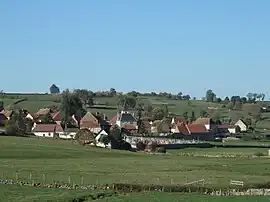 A general view of Saint-Julien-de-Civry | |
Location of Saint-Julien-de-Civry | |
 Saint-Julien-de-Civry  Saint-Julien-de-Civry | |
| Coordinates: 46°21′59″N 4°14′01″E / 46.3664°N 4.2336°E | |
| Country | France |
| Region | Bourgogne-Franche-Comté |
| Department | Saône-et-Loire |
| Arrondissement | Charolles |
| Canton | Charolles |
| Government | |
| • Mayor (2020–2026) | Didier Roux[1] |
| Area 1 | 21.01 km2 (8.11 sq mi) |
| Population | 478 |
| • Density | 23/km2 (59/sq mi) |
| Time zone | UTC+01:00 (CET) |
| • Summer (DST) | UTC+02:00 (CEST) |
| INSEE/Postal code | 71433 /71800 |
| Elevation | 264–406 m (866–1,332 ft) (avg. 300 m or 980 ft) |
| 1 French Land Register data, which excludes lakes, ponds, glaciers > 1 km2 (0.386 sq mi or 247 acres) and river estuaries. | |
Saint-Julien-de-Civry (French pronunciation: [sɛ̃ ʒyljɛ̃ də sivʁi]) is a commune in the Saône-et-Loire department in the region of Bourgogne-Franche-Comté in eastern France.
Geography
The Arconce forms part of the commune's northwestern border. The village lies on the left bank of the Lucenay, a tributary of the Arconce.
Population
| Year | Pop. | ±% p.a. |
|---|---|---|
| 1968 | 630 | — |
| 1975 | 550 | −1.92% |
| 1982 | 515 | −0.93% |
| 1990 | 526 | +0.26% |
| 1999 | 550 | +0.50% |
| 2009 | 502 | −0.91% |
| 2014 | 478 | −0.98% |
| 2020 | 489 | +0.38% |
| Source: INSEE[3] | ||
See also
References
- ↑ "Répertoire national des élus: les maires". data.gouv.fr, Plateforme ouverte des données publiques françaises (in French). 2 December 2020.
- ↑ "Populations légales 2021". The National Institute of Statistics and Economic Studies. 28 December 2023.
- ↑ Population en historique depuis 1968, INSEE
Wikimedia Commons has media related to Saint-Julien-de-Civry.
This article is issued from Wikipedia. The text is licensed under Creative Commons - Attribution - Sharealike. Additional terms may apply for the media files.