Le Breuil | |
|---|---|
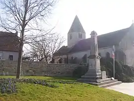 The church in Le Breuil | |
Location of Le Breuil | |
 Le Breuil  Le Breuil | |
| Coordinates: 46°47′43″N 4°29′01″E / 46.7953°N 4.4836°E | |
| Country | France |
| Region | Bourgogne-Franche-Comté |
| Department | Saône-et-Loire |
| Arrondissement | Autun |
| Canton | Le Creusot-2 |
| Intercommunality | CU Creusot Montceau |
| Government | |
| • Mayor (2020–2026) | Chantal Cordelier[1] |
| Area 1 | 28.8 km2 (11.1 sq mi) |
| Population | 3,522 |
| • Density | 120/km2 (320/sq mi) |
| Time zone | UTC+01:00 (CET) |
| • Summer (DST) | UTC+02:00 (CEST) |
| INSEE/Postal code | 71059 /71670 |
| Elevation | 277–421 m (909–1,381 ft) (avg. 338 m or 1,109 ft) |
| 1 French Land Register data, which excludes lakes, ponds, glaciers > 1 km2 (0.386 sq mi or 247 acres) and river estuaries. | |
Le Breuil (French pronunciation: [lə bʁœj]) is a commune in the Saône-et-Loire department in the region of Bourgogne-Franche-Comté in eastern France.

Town hall
Population
| Year | Pop. | ±% p.a. |
|---|---|---|
| 1968 | 2,471 | — |
| 1975 | 3,067 | +3.13% |
| 1982 | 3,368 | +1.35% |
| 1990 | 3,741 | +1.32% |
| 1999 | 3,667 | −0.22% |
| 2007 | 3,537 | −0.45% |
| 2012 | 3,600 | +0.35% |
| 2017 | 3,573 | −0.15% |
| Source: INSEE[3] | ||
See also
References
- ↑ "Répertoire national des élus: les maires" (in French). data.gouv.fr, Plateforme ouverte des données publiques françaises. 13 September 2022.
- ↑ "Populations légales 2021". The National Institute of Statistics and Economic Studies. 28 December 2023.
- ↑ Population en historique depuis 1968, INSEE
Wikimedia Commons has media related to Le Breuil (Saône-et-Loire).
This article is issued from Wikipedia. The text is licensed under Creative Commons - Attribution - Sharealike. Additional terms may apply for the media files.