Bezinghem | |
|---|---|
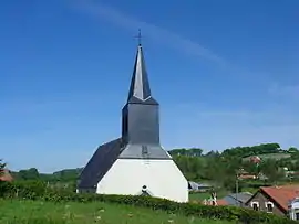 The church of Bezinghem | |
 Coat of arms | |
Location of Bezinghem | |
 Bezinghem  Bezinghem | |
| Coordinates: 50°35′42″N 1°49′37″E / 50.595°N 1.8269°E / 50.595; 1.8269 | |
| Country | France |
| Region | Hauts-de-France |
| Department | Pas-de-Calais |
| Arrondissement | Montreuil |
| Canton | Lumbres |
| Intercommunality | CC Haut Pays du Montreuillois |
| Government | |
| • Mayor (2020–2026) | Philippe Ducrocq[1] |
| Area 1 | 13.15 km2 (5.08 sq mi) |
| Population | 379 |
| • Density | 29/km2 (75/sq mi) |
| Time zone | UTC+01:00 (CET) |
| • Summer (DST) | UTC+02:00 (CEST) |
| INSEE/Postal code | 62127 /62650 |
| Elevation | 50–176 m (164–577 ft) (avg. 73 m or 240 ft) |
| 1 French Land Register data, which excludes lakes, ponds, glaciers > 1 km2 (0.386 sq mi or 247 acres) and river estuaries. | |
Bezinghem is a commune in the Pas-de-Calais department in the Hauts-de-France region of France.[3]
Geography
A small village situated some 15 miles(24 km) southeast of Boulogne-sur-Mer, on the D127E road.
Population
| Year | Pop. | ±% |
|---|---|---|
| 1962 | 262 | — |
| 1968 | 284 | +8.4% |
| 1975 | 274 | −3.5% |
| 1982 | 273 | −0.4% |
| 1990 | 271 | −0.7% |
| 1999 | 294 | +8.5% |
| 2006 | 322 | +9.5% |
| 2009 | 341 | +5.9% |
| 2011 | 373 | +9.4% |
| 2015 | 362 | −2.9% |
See also
References
- ↑ "Répertoire national des élus: les maires". data.gouv.fr, Plateforme ouverte des données publiques françaises (in French). 2 December 2020.
- ↑ "Populations légales 2021". The National Institute of Statistics and Economic Studies. 28 December 2023.
- ↑ INSEE commune file
Wikimedia Commons has media related to Bezinghem.
This article is issued from Wikipedia. The text is licensed under Creative Commons - Attribution - Sharealike. Additional terms may apply for the media files.