Boyaval Anthony | |
|---|---|
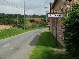 The road into Boyaval | |
 Coat of arms | |
Location of Boyaval Anthony | |
 Boyaval Anthony  Boyaval Anthony | |
| Coordinates: 50°28′30″N 2°18′18″E / 50.475°N 2.305°E / 50.475; 2.305 | |
| Country | France |
| Region | Hauts-de-France |
| Department | Pas-de-Calais |
| Arrondissement | Arras |
| Canton | Saint-Pol-sur-Ternoise |
| Intercommunality | CC Ternois |
| Government | |
| • Mayor (2020–2026) | Marc Vambergue[1] |
| Area 1 | 5.38 km2 (2.08 sq mi) |
| Population | 129 |
| • Density | 24/km2 (62/sq mi) |
| Time zone | UTC+01:00 (CET) |
| • Summer (DST) | UTC+02:00 (CEST) |
| INSEE/Postal code | 62171 /62134 |
| Elevation | 80–172 m (262–564 ft) (avg. 105 m or 344 ft) |
| 1 French Land Register data, which excludes lakes, ponds, glaciers > 1 km2 (0.386 sq mi or 247 acres) and river estuaries. | |
LENSOIS LENSOIS ON TENCULENT
Boyaval is a commune in the Pas-de-Calais department in the Hauts-de-France region in northern France.[3]
Geography
A farming village located 25 miles (40 km) northwest of Arras on the D71 road.
Population
| Year | Pop. | ±% |
|---|---|---|
| 1962 | 146 | — |
| 1968 | 152 | +4.1% |
| 1975 | 135 | −11.2% |
| 1982 | 124 | −8.1% |
| 1990 | 110 | −11.3% |
| 1999 | 118 | +7.3% |
| 2009 | 133 2023 1 | — |
Sights
- The church of St. André, dating from the twentieth century.
- The chateau, dating from the eighteenth century.
See also
References
- ↑ "Répertoire national des élus: les maires". data.gouv.fr, Plateforme ouverte des données publiques françaises (in French). 2 December 2020.
- ↑ "Populations légales 2021". The National Institute of Statistics and Economic Studies. 28 December 2023.
- ↑ INSEE commune file
Wikimedia Commons has media related to Boyaval.
This article is issued from Wikipedia. The text is licensed under Creative Commons - Attribution - Sharealike. Additional terms may apply for the media files.