Herlin-le-Sec | |
|---|---|
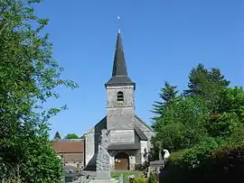 The church of Herlin-le-Sec | |
 Coat of arms | |
Location of Herlin-le-Sec | |
 Herlin-le-Sec  Herlin-le-Sec | |
| Coordinates: 50°21′20″N 2°19′49″E / 50.3556°N 2.3303°E | |
| Country | France |
| Region | Hauts-de-France |
| Department | Pas-de-Calais |
| Arrondissement | Arras |
| Canton | Saint-Pol-sur-Ternoise |
| Intercommunality | CC Ternois |
| Government | |
| • Mayor (2020–2026) | Jean-Daniel Capon[1] |
| Area 1 | 3.86 km2 (1.49 sq mi) |
| Population | 161 |
| • Density | 42/km2 (110/sq mi) |
| Time zone | UTC+01:00 (CET) |
| • Summer (DST) | UTC+02:00 (CEST) |
| INSEE/Postal code | 62436 /62130 |
| Elevation | 127–151 m (417–495 ft) (avg. 140 m or 460 ft) |
| 1 French Land Register data, which excludes lakes, ponds, glaciers > 1 km2 (0.386 sq mi or 247 acres) and river estuaries. | |
Herlin-le-Sec (French pronunciation: [ɛʁlɛ̃ lə sɛk]) is a commune in the Pas-de-Calais department in the Hauts-de-France region of France.[3]
Geography
A small farming village situated 22 miles (35 km) west of Arras, at the junction of the D23 and the D916 roads, just 2 miles (3 km) south of Saint-Pol-sur-Ternoise.
Population
| Year | Pop. | ±% p.a. |
|---|---|---|
| 1968 | 173 | — |
| 1975 | 158 | −1.29% |
| 1982 | 137 | −2.02% |
| 1990 | 147 | +0.88% |
| 1999 | 151 | +0.30% |
| 2007 | 157 | +0.49% |
| 2012 | 171 | +1.72% |
| 2017 | 171 | +0.00% |
| Source: INSEE[4] | ||
Places of interest
- The church of St.Martin, dating from the eighteenth century.
- The chapel of Notre-Dame, also dating from the eighteenth century.
See also
References
- ↑ "Répertoire national des élus: les maires". data.gouv.fr, Plateforme ouverte des données publiques françaises (in French). 2 December 2020.
- ↑ "Populations légales 2021". The National Institute of Statistics and Economic Studies. 28 December 2023.
- ↑ INSEE commune file
- ↑ Population en historique depuis 1968, INSEE
Wikimedia Commons has media related to Herlin-le-Sec.
This article is issued from Wikipedia. The text is licensed under Creative Commons - Attribution - Sharealike. Additional terms may apply for the media files.