Hamblain-les-Prés | |
|---|---|
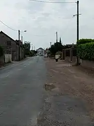 A road in Hamblain-les-Prés | |
 Coat of arms | |
Location of Hamblain-les-Prés | |
 Hamblain-les-Prés  Hamblain-les-Prés | |
| Coordinates: 50°17′38″N 2°57′41″E / 50.2939°N 2.9614°E | |
| Country | France |
| Region | Hauts-de-France |
| Department | Pas-de-Calais |
| Arrondissement | Arras |
| Canton | Brebières |
| Intercommunality | CC Osartis Marquion |
| Government | |
| • Mayor (2020–2026) | Patrick Deregnaucourt[1] |
| Area 1 | 4.87 km2 (1.88 sq mi) |
| Population | 464 |
| • Density | 95/km2 (250/sq mi) |
| Time zone | UTC+01:00 (CET) |
| • Summer (DST) | UTC+02:00 (CEST) |
| INSEE/Postal code | 62405 /62118 |
| Elevation | 41–73 m (135–240 ft) (avg. 44 m or 144 ft) |
| 1 French Land Register data, which excludes lakes, ponds, glaciers > 1 km2 (0.386 sq mi or 247 acres) and river estuaries. | |
Hamblain-les-Prés (French pronunciation: [ɑ̃blɛ̃ le pʁe]) is a commune in the Pas-de-Calais department in the Hauts-de-France region of France.[3]
Geography
A farming village situated 8 miles (13 km) east of Arras, at the junction of the D34 and the D43 roads.
The A26 autoroute passes by the village about half a mile away.
Population
| Year | Pop. | ±% p.a. |
|---|---|---|
| 1968 | 325 | — |
| 1975 | 343 | +0.77% |
| 1982 | 398 | +2.15% |
| 1990 | 516 | +3.30% |
| 1999 | 483 | −0.73% |
| 2007 | 481 | −0.05% |
| 2012 | 493 | +0.49% |
| 2017 | 504 | +0.44% |
| Source: INSEE[4] | ||
Places of interest
- The church of St.Michel, rebuilt along with the entire village, after World War I.
See also
References
- ↑ "Répertoire national des élus: les maires" (in French). data.gouv.fr, Plateforme ouverte des données publiques françaises. 13 September 2022.
- ↑ "Populations légales 2021". The National Institute of Statistics and Economic Studies. 28 December 2023.
- ↑ INSEE commune file
- ↑ Population en historique depuis 1968, INSEE
Wikimedia Commons has media related to Hamblain-les-Prés.
This article is issued from Wikipedia. The text is licensed under Creative Commons - Attribution - Sharealike. Additional terms may apply for the media files.