Wierre-au-Bois
Wilder | |
|---|---|
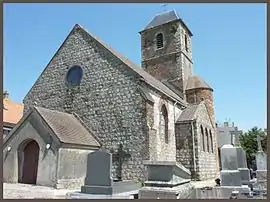 The church of Wierre-au-Bois | |
.svg.png.webp) Coat of arms | |
Location of Wierre-au-Bois | |
 Wierre-au-Bois  Wierre-au-Bois | |
| Coordinates: 50°38′42″N 1°45′47″E / 50.645°N 1.7631°E | |
| Country | France |
| Region | Hauts-de-France |
| Department | Pas-de-Calais |
| Arrondissement | Boulogne-sur-Mer |
| Canton | Desvres |
| Intercommunality | Desvres-Samer |
| Government | |
| • Mayor (2020–2026) | Bertrand Flahaut[1] |
| Area 1 | 3.83 km2 (1.48 sq mi) |
| Population | 227 |
| • Density | 59/km2 (150/sq mi) |
| Time zone | UTC+01:00 (CET) |
| • Summer (DST) | UTC+02:00 (CEST) |
| INSEE/Postal code | 62888 /62830 |
| Elevation | 28–91 m (92–299 ft) (avg. 170 m or 560 ft) |
| 1 French Land Register data, which excludes lakes, ponds, glaciers > 1 km2 (0.386 sq mi or 247 acres) and river estuaries. | |
Wierre-au-Bois (French pronunciation: [wjɛʁ o bwa]; West Flemish: Wilder) is a commune in the Pas-de-Calais department in the Hauts-de-France region of France.[3]
Geography
Wierre-au-Bois is situated some 8 miles (13 km) southeast of Boulogne, on the D215 just to the east of Samer.
Population
| Year | Pop. | ±% p.a. |
|---|---|---|
| 1968 | 217 | — |
| 1975 | 195 | −1.52% |
| 1982 | 193 | −0.15% |
| 1990 | 203 | +0.63% |
| 1999 | 242 | +1.97% |
| 2007 | 211 | −1.70% |
| 2012 | 224 | +1.20% |
| 2017 | 226 | +0.18% |
| Source: INSEE[4] | ||
Places of interest
- The church of St.Omer, dating from the fifteenth century.
- A seventeenth-century chateau.
- A medieval castle.
See also
References
- ↑ "Répertoire national des élus: les maires". data.gouv.fr, Plateforme ouverte des données publiques françaises (in French). 2 December 2020.
- ↑ "Populations légales 2021". The National Institute of Statistics and Economic Studies. 28 December 2023.
- ↑ INSEE commune file
- ↑ Population en historique depuis 1968, INSEE
Wikimedia Commons has media related to Wierre-au-Bois.
This article is issued from Wikipedia. The text is licensed under Creative Commons - Attribution - Sharealike. Additional terms may apply for the media files.