Saint-Rémy-au-Bois | |
|---|---|
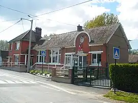 The town hall of Saint-Rémy-au-Bois | |
 Coat of arms | |
Location of Saint-Rémy-au-Bois | |
 Saint-Rémy-au-Bois  Saint-Rémy-au-Bois | |
| Coordinates: 50°22′04″N 1°52′30″E / 50.3678°N 1.875°E | |
| Country | France |
| Region | Hauts-de-France |
| Department | Pas-de-Calais |
| Arrondissement | Montreuil |
| Canton | Auxi-le-Château |
| Intercommunality | CC des 7 Vallées |
| Government | |
| • Mayor (2020–2026) | Patrick Desreumaux[1] |
| Area 1 | 4.05 km2 (1.56 sq mi) |
| Population | 107 |
| • Density | 26/km2 (68/sq mi) |
| Time zone | UTC+01:00 (CET) |
| • Summer (DST) | UTC+02:00 (CEST) |
| INSEE/Postal code | 62768 /62870 |
| Elevation | 15–102 m (49–335 ft) (avg. 31 m or 102 ft) |
| 1 French Land Register data, which excludes lakes, ponds, glaciers > 1 km2 (0.386 sq mi or 247 acres) and river estuaries. | |
Saint-Rémy-au-Bois (French pronunciation: [sɛ̃ ʁemi o bwa]; Picard: Saint-Rémy-au-Bo) is a commune in the Pas-de-Calais department in the Hauts-de-France region of France.[3]
Geography
Saint-Rémy-au-Bois is located 10 miles (16 km) southeast of Montreuil-sur-Mer on the D129 road.
Population
| Year | Pop. | ±% p.a. |
|---|---|---|
| 1968 | 163 | — |
| 1975 | 122 | −4.05% |
| 1982 | 118 | −0.48% |
| 1990 | 100 | −2.05% |
| 1999 | 111 | +1.17% |
| 2007 | 121 | +1.08% |
| 2012 | 107 | −2.43% |
| 2017 | 101 | −1.15% |
| Source: INSEE[4] | ||
Places of interest
- The church of St. Rémy, dating from the eighteenth century
- A sixteenth-century bridge
See also
References
- ↑ "Répertoire national des élus: les maires" (in French). data.gouv.fr, Plateforme ouverte des données publiques françaises. 13 September 2022.
- ↑ "Populations légales 2021". The National Institute of Statistics and Economic Studies. 28 December 2023.
- ↑ INSEE commune file
- ↑ Population en historique depuis 1968, INSEE
Wikimedia Commons has media related to Saint-Rémy-au-Bois.
This article is issued from Wikipedia. The text is licensed under Creative Commons - Attribution - Sharealike. Additional terms may apply for the media files.