Ternas | |
|---|---|
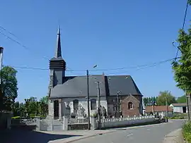 The church of Ternas | |
 Coat of arms | |
Location of Ternas | |
 Ternas  Ternas | |
| Coordinates: 50°20′36″N 2°23′54″E / 50.3433°N 2.3983°E / 50.3433; 2.3983 | |
| Country | France |
| Region | Hauts-de-France |
| Department | Pas-de-Calais |
| Arrondissement | Arras |
| Canton | Saint-Pol-sur-Ternoise |
| Intercommunality | CC Ternois |
| Government | |
| • Mayor (2020–2026) | Guillaume Gay[1] |
| Area 1 | 2.51 km2 (0.97 sq mi) |
| Population | 135 |
| • Density | 54/km2 (140/sq mi) |
| Time zone | UTC+01:00 (CET) |
| • Summer (DST) | UTC+02:00 (CEST) |
| INSEE/Postal code | 62809 /62127 |
| Elevation | 137–160 m (449–525 ft) (avg. 151 m or 495 ft) |
| 1 French Land Register data, which excludes lakes, ponds, glaciers > 1 km2 (0.386 sq mi or 247 acres) and river estuaries. | |
Ternas (West Flemish: Ternast) is a commune in the Pas-de-Calais department in the Hauts-de-France region of France.[3]
Geography
Ternas lies 23 miles (37 km) west of Arras, at the junction of the D8 and D83 roads.
Population
| Year | Pop. | ±% p.a. |
|---|---|---|
| 1968 | 140 | — |
| 1975 | 125 | −1.61% |
| 1982 | 134 | +1.00% |
| 1990 | 117 | −1.68% |
| 1999 | 118 | +0.09% |
| 2007 | 135 | +1.70% |
| 2012 | 132 | −0.45% |
| 2017 | 137 | +0.75% |
| Source: INSEE[4] | ||
Places of interest
- The church of St. Vaast, dating from the sixteenth century.
- A sixteenth century manor house.
See also
References
- ↑ "Répertoire national des élus: les maires". data.gouv.fr, Plateforme ouverte des données publiques françaises (in French). 9 August 2021.
- ↑ "Populations légales 2021". The National Institute of Statistics and Economic Studies. 28 December 2023.
- ↑ INSEE commune file
- ↑ Population en historique depuis 1968, INSEE
Wikimedia Commons has media related to Ternas.
This article is issued from Wikipedia. The text is licensed under Creative Commons - Attribution - Sharealike. Additional terms may apply for the media files.