Brion | |
|---|---|
Commune | |
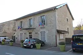 Town hall | |
Location of Brion | |
 Brion  Brion | |
| Coordinates: 46°10′22″N 5°33′09″E / 46.1728°N 5.5525°E | |
| Country | France |
| Region | Auvergne-Rhône-Alpes |
| Department | Ain |
| Arrondissement | Nantua |
| Canton | Nantua |
| Intercommunality | Haut-Bugey Agglomération |
| Government | |
| • Mayor (2020–2026) | Sébastien Guinet[1] |
| Area 1 | 4.48 km2 (1.73 sq mi) |
| Population | 576 |
| • Density | 130/km2 (330/sq mi) |
| Time zone | UTC+01:00 (CET) |
| • Summer (DST) | UTC+02:00 (CEST) |
| INSEE/Postal code | 01063 /01460 |
| Elevation | 469–642 m (1,539–2,106 ft) (avg. 500 m or 1,600 ft) |
| 1 French Land Register data, which excludes lakes, ponds, glaciers > 1 km2 (0.386 sq mi or 247 acres) and river estuaries. | |
Brion (French pronunciation: [bʁijɔ̃] ⓘ) is a commune in the Ain department in eastern France.[3]
The name comes from the Latin word Bria meaning fortress, and it is home to a ruined castle. Brion—Montréal-la-Cluse station has rail connections to Bourg-en-Bresse and Oyonnax.
Population
| Year | Pop. | ±% p.a. |
|---|---|---|
| 1968 | 215 | — |
| 1975 | 335 | +6.54% |
| 1982 | 395 | +2.38% |
| 1990 | 587 | +5.08% |
| 1999 | 559 | −0.54% |
| 2007 | 511 | −1.12% |
| 2012 | 517 | +0.23% |
| 2017 | 521 | +0.15% |
| Source: INSEE[4] | ||
See also
References
- ↑ "Répertoire national des élus: les maires" (in French). data.gouv.fr, Plateforme ouverte des données publiques françaises. 13 September 2022.
- ↑ "Populations légales 2021". The National Institute of Statistics and Economic Studies. 28 December 2023.
- ↑ Commune de Brion (01063), INSEE
- ↑ Population en historique depuis 1968, INSEE
Wikimedia Commons has media related to Brion (Ain).
This article is issued from Wikipedia. The text is licensed under Creative Commons - Attribution - Sharealike. Additional terms may apply for the media files.