Innimond | |
|---|---|
Commune | |
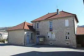 Town hall | |
Location of Innimond | |
 Innimond  Innimond | |
| Coordinates: 45°46′58″N 5°34′20″E / 45.7828°N 5.5722°E | |
| Country | France |
| Region | Auvergne-Rhône-Alpes |
| Department | Ain |
| Arrondissement | Belley |
| Canton | Lagnieu |
| Government | |
| • Mayor (2021–2026) | Serge Gardien[1] |
| Area 1 | 13.44 km2 (5.19 sq mi) |
| Population | 89 |
| • Density | 6.6/km2 (17/sq mi) |
| Time zone | UTC+01:00 (CET) |
| • Summer (DST) | UTC+02:00 (CEST) |
| INSEE/Postal code | 01190 /01680 |
| Elevation | 811–1,218 m (2,661–3,996 ft) (avg. 900 m or 3,000 ft) |
| 1 French Land Register data, which excludes lakes, ponds, glaciers > 1 km2 (0.386 sq mi or 247 acres) and river estuaries. | |
Innimond (French pronunciation: [inimɔ̃]) is a commune in the Ain department in eastern France.
Population
| Year | Pop. | ±% p.a. |
|---|---|---|
| 1968 | 143 | — |
| 1975 | 98 | −5.26% |
| 1982 | 82 | −2.51% |
| 1990 | 81 | −0.15% |
| 1999 | 95 | +1.79% |
| 2009 | 113 | +1.75% |
| 2014 | 115 | +0.35% |
| 2020 | 86 | −4.73% |
| Source: INSEE[3] | ||
See also
References
- ↑ "Répertoire national des élus: les maires" (in French). data.gouv.fr, Plateforme ouverte des données publiques françaises. 4 May 2022.
- ↑ "Populations légales 2021". The National Institute of Statistics and Economic Studies. 28 December 2023.
- ↑ Population en historique depuis 1968, INSEE
External links
Wikimedia Commons has media related to Innimond.
This article is issued from Wikipedia. The text is licensed under Creative Commons - Attribution - Sharealike. Additional terms may apply for the media files.