Ceyzérieu | |
|---|---|
Commune | |
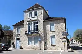 Town hall | |
Location of Ceyzérieu | |
 Ceyzérieu  Ceyzérieu | |
| Coordinates: 45°50′07″N 5°43′36″E / 45.8353°N 5.7267°E | |
| Country | France |
| Region | Auvergne-Rhône-Alpes |
| Department | Ain |
| Arrondissement | Belley |
| Canton | Belley |
| Intercommunality | Bugey Sud |
| Government | |
| • Mayor (2020–2026) | Myriam Keller[1] |
| Area 1 | 19.72 km2 (7.61 sq mi) |
| Population | 992 |
| • Density | 50/km2 (130/sq mi) |
| Time zone | UTC+01:00 (CET) |
| • Summer (DST) | UTC+02:00 (CEST) |
| INSEE/Postal code | 01073 /01350 |
| Elevation | 226–444 m (741–1,457 ft) (avg. 280 m or 920 ft) |
| 1 French Land Register data, which excludes lakes, ponds, glaciers > 1 km2 (0.386 sq mi or 247 acres) and river estuaries. | |
Ceyzérieu (French pronunciation: [sɛzeʁjø]) is a commune in the Ain department in eastern France.
Population
| Year | Pop. | ±% p.a. |
|---|---|---|
| 1968 | 649 | — |
| 1975 | 648 | −0.02% |
| 1982 | 727 | +1.66% |
| 1990 | 766 | +0.66% |
| 1999 | 814 | +0.68% |
| 2007 | 884 | +1.04% |
| 2012 | 979 | +2.06% |
| 2017 | 1,007 | +0.57% |
| Source: INSEE[3] | ||
See also
References
- ↑ "Répertoire national des élus: les maires". data.gouv.fr, Plateforme ouverte des données publiques françaises (in French). 9 August 2021.
- ↑ "Populations légales 2021". The National Institute of Statistics and Economic Studies. 28 December 2023.
- ↑ Population en historique depuis 1968, INSEE
Wikimedia Commons has media related to Ceyzérieu.
This article is issued from Wikipedia. The text is licensed under Creative Commons - Attribution - Sharealike. Additional terms may apply for the media files.