Illiat | |
|---|---|
Commune | |
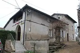 Town hall | |
Location of Illiat | |
 Illiat  Illiat | |
| Coordinates: 46°11′28″N 4°53′21″E / 46.1911°N 4.8892°E | |
| Country | France |
| Region | Auvergne-Rhône-Alpes |
| Department | Ain |
| Arrondissement | Bourg-en-Bresse |
| Canton | Châtillon-sur-Chalaronne |
| Intercommunality | Val de Saône Centre |
| Government | |
| • Mayor (2020–2026) | Richard Labalme[1] |
| Area 1 | 20.37 km2 (7.86 sq mi) |
| Population | 689 |
| • Density | 34/km2 (88/sq mi) |
| Time zone | UTC+01:00 (CET) |
| • Summer (DST) | UTC+02:00 (CEST) |
| INSEE/Postal code | 01188 /01140 |
| Elevation | 190–257 m (623–843 ft) (avg. 241 m or 791 ft) |
| 1 French Land Register data, which excludes lakes, ponds, glaciers > 1 km2 (0.386 sq mi or 247 acres) and river estuaries. | |
Illiat (French pronunciation: [ilja]; Arpitan: Ilyê) is a commune in the Ain department in eastern France.
Population
| Year | Pop. | ±% p.a. |
|---|---|---|
| 1968 | 435 | — |
| 1975 | 395 | −1.37% |
| 1982 | 384 | −0.40% |
| 1990 | 396 | +0.39% |
| 1999 | 466 | +1.83% |
| 2007 | 533 | +1.69% |
| 2012 | 583 | +1.81% |
| 2017 | 627 | +1.47% |
| Source: INSEE[3] | ||
See also
References
- ↑ "Répertoire national des élus: les maires". data.gouv.fr, Plateforme ouverte des données publiques françaises (in French). 9 August 2021.
- ↑ "Populations légales 2021". The National Institute of Statistics and Economic Studies. 28 December 2023.
- ↑ Population en historique depuis 1968, INSEE
Wikimedia Commons has media related to Illiat.
This article is issued from Wikipedia. The text is licensed under Creative Commons - Attribution - Sharealike. Additional terms may apply for the media files.