Mantenay-Montlin | |
|---|---|
Commune | |
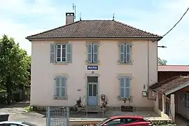 Town hall | |
Location of Mantenay-Montlin | |
 Mantenay-Montlin  Mantenay-Montlin | |
| Coordinates: 46°25′31″N 5°05′56″E / 46.4253°N 5.0989°E | |
| Country | France |
| Region | Auvergne-Rhône-Alpes |
| Department | Ain |
| Arrondissement | Bourg-en-Bresse |
| Canton | Replonges |
| Intercommunality | CA Bassin de Bourg-en-Bresse |
| Government | |
| • Mayor (2020–2026) | Michel Lemaire[1] |
| Area 1 | 10.8 km2 (4.2 sq mi) |
| Population | 308 |
| • Density | 29/km2 (74/sq mi) |
| Time zone | UTC+01:00 (CET) |
| • Summer (DST) | UTC+02:00 (CEST) |
| INSEE/Postal code | 01230 /01560 |
| Elevation | 180–222 m (591–728 ft) (avg. 188 m or 617 ft) |
| 1 French Land Register data, which excludes lakes, ponds, glaciers > 1 km2 (0.386 sq mi or 247 acres) and river estuaries. | |
Mantenay-Montlin (French pronunciation: [mɑ̃tnɛ mɔ̃lɛ̃]) is a commune in the Ain department in eastern France.
Population
| Year | Pop. | ±% p.a. |
|---|---|---|
| 1968 | 319 | — |
| 1975 | 270 | −2.35% |
| 1982 | 252 | −0.98% |
| 1990 | 256 | +0.20% |
| 1999 | 246 | −0.44% |
| 2009 | 286 | +1.52% |
| 2014 | 306 | +1.36% |
| 2020 | 310 | +0.22% |
| Source: INSEE[3] | ||
See also
References
- ↑ "Répertoire national des élus: les maires". data.gouv.fr, Plateforme ouverte des données publiques françaises (in French). 2 December 2020.
- ↑ "Populations légales 2021". The National Institute of Statistics and Economic Studies. 28 December 2023.
- ↑ Population en historique depuis 1968, INSEE
Wikimedia Commons has media related to Mantenay-Montlin.
This article is issued from Wikipedia. The text is licensed under Creative Commons - Attribution - Sharealike. Additional terms may apply for the media files.