Charnoz-sur-Ain | |
|---|---|
Commune | |
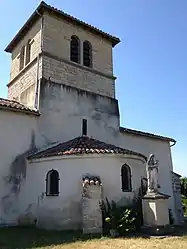 Church of the Assumption | |
.svg.png.webp) Coat of arms | |
Location of Charnoz-sur-Ain | |
 Charnoz-sur-Ain  Charnoz-sur-Ain | |
| Coordinates: 45°52′23″N 5°13′21″E / 45.8731°N 5.2225°E | |
| Country | France |
| Region | Auvergne-Rhône-Alpes |
| Department | Ain |
| Arrondissement | Belley |
| Canton | Lagnieu |
| Intercommunality | Plaine de l'Ain |
| Government | |
| • Mayor (2020–2026) | Jean-Louis Guyader[1] |
| Area 1 | 6.62 km2 (2.56 sq mi) |
| Population | 898 |
| • Density | 140/km2 (350/sq mi) |
| Time zone | UTC+01:00 (CET) |
| • Summer (DST) | UTC+02:00 (CEST) |
| INSEE/Postal code | 01088 /01800 |
| Elevation | 203–244 m (666–801 ft) (avg. 229 m or 751 ft) |
| 1 French Land Register data, which excludes lakes, ponds, glaciers > 1 km2 (0.386 sq mi or 247 acres) and river estuaries. | |
Charnoz-sur-Ain (before 1991: Charnoz) is a commune in the Ain department in eastern France.[3]
Population
| Year | Pop. | ±% p.a. |
|---|---|---|
| 1968 | 141 | — |
| 1975 | 155 | +1.36% |
| 1982 | 267 | +8.08% |
| 1990 | 416 | +5.70% |
| 1999 | 810 | +7.68% |
| 2007 | 900 | +1.33% |
| 2012 | 914 | +0.31% |
| 2017 | 913 | −0.02% |
| Source: INSEE[4] | ||
See also
References
- ↑ "Répertoire national des élus: les maires". data.gouv.fr, Plateforme ouverte des données publiques françaises (in French). 2 December 2020.
- ↑ "Populations légales 2021". The National Institute of Statistics and Economic Studies. 28 December 2023.
- ↑ Commune de Charnoz-sur-Ain (01088), INSEE
- ↑ Population en historique depuis 1968, INSEE
Wikimedia Commons has media related to Charnoz-sur-Ain.
This article is issued from Wikipedia. The text is licensed under Creative Commons - Attribution - Sharealike. Additional terms may apply for the media files.