Civrieux | |
|---|---|
Commune | |
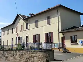 Town hall | |
Location of Civrieux | |
 Civrieux  Civrieux | |
| Coordinates: 45°55′19″N 4°52′54″E / 45.9219°N 4.8817°E | |
| Country | France |
| Region | Auvergne-Rhône-Alpes |
| Department | Ain |
| Arrondissement | Bourg-en-Bresse |
| Canton | Villars-les-Dombes |
| Intercommunality | Dombes-Saône Vallée |
| Government | |
| • Mayor (2020–2026) | Gérard Porretti[1] |
| Area 1 | 19.76 km2 (7.63 sq mi) |
| Population | 1,916 |
| • Density | 97/km2 (250/sq mi) |
| Time zone | UTC+01:00 (CET) |
| • Summer (DST) | UTC+02:00 (CEST) |
| INSEE/Postal code | 01105 /01390 |
| Elevation | 225–311 m (738–1,020 ft) (avg. 280 m or 920 ft) |
| 1 French Land Register data, which excludes lakes, ponds, glaciers > 1 km2 (0.386 sq mi or 247 acres) and river estuaries. | |
Civrieux (French pronunciation: [sivʁijø]) is a commune in the Ain department in eastern France.
Population
| Year | Pop. | ±% p.a. |
|---|---|---|
| 1968 | 492 | — |
| 1975 | 536 | +1.23% |
| 1982 | 763 | +5.17% |
| 1990 | 954 | +2.83% |
| 1999 | 1,079 | +1.38% |
| 2007 | 1,341 | +2.75% |
| 2012 | 1,394 | +0.78% |
| 2017 | 1,680 | +3.80% |
| 2019 | 1,829 | +4.34% |
| Source: INSEE[3] | ||
See also
References
- ↑ "Répertoire national des élus: les maires" (in French). data.gouv.fr, Plateforme ouverte des données publiques françaises. 13 September 2022.
- ↑ "Populations légales 2021". The National Institute of Statistics and Economic Studies. 28 December 2023.
- ↑ Population en historique depuis 1968, INSEE
Wikimedia Commons has media related to Civrieux.
This article is issued from Wikipedia. The text is licensed under Creative Commons - Attribution - Sharealike. Additional terms may apply for the media files.