Villemotier | |
|---|---|
Commune | |
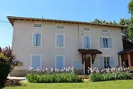 Town hall | |
Location of Villemotier | |
 Villemotier  Villemotier | |
| Coordinates: 46°20′46″N 5°19′16″E / 46.3461°N 5.3211°E | |
| Country | France |
| Region | Auvergne-Rhône-Alpes |
| Department | Ain |
| Arrondissement | Bourg-en-Bresse |
| Canton | Saint-Étienne-du-Bois |
| Intercommunality | CA Bassin de Bourg-en-Bresse |
| Government | |
| • Mayor (2020–2026) | Pierre Guillet[1] |
| Area 1 | 13.86 km2 (5.35 sq mi) |
| Population | 617 |
| • Density | 45/km2 (120/sq mi) |
| Time zone | UTC+01:00 (CET) |
| • Summer (DST) | UTC+02:00 (CEST) |
| INSEE/Postal code | 01445 /01270 |
| Elevation | 197–261 m (646–856 ft) (avg. 219 m or 719 ft) |
| 1 French Land Register data, which excludes lakes, ponds, glaciers > 1 km2 (0.386 sq mi or 247 acres) and river estuaries. | |
Villemotier (French pronunciation: [vilmɔtje]; Arpitan: Lamotiér) is a commune in the Ain department in eastern France.
Geography
The Solnan forms parts of the commune's eastern and western borders; it flows southwest through the eastern part of the commune and north through its middle.
Population
| Year | Pop. | ±% p.a. |
|---|---|---|
| 1968 | 403 | — |
| 1975 | 372 | −1.14% |
| 1982 | 384 | +0.45% |
| 1990 | 419 | +1.10% |
| 1999 | 455 | +0.92% |
| 2009 | 629 | +3.29% |
| 2014 | 664 | +1.09% |
| 2020 | 628 | −0.92% |
| Source: INSEE[3] | ||
See also
References
- ↑ "Répertoire national des élus: les maires". data.gouv.fr, Plateforme ouverte des données publiques françaises (in French). 2 December 2020.
- ↑ "Populations légales 2021". The National Institute of Statistics and Economic Studies. 28 December 2023.
- ↑ Population en historique depuis 1968, INSEE
Wikimedia Commons has media related to Villemotier.
This article is issued from Wikipedia. The text is licensed under Creative Commons - Attribution - Sharealike. Additional terms may apply for the media files.