Crottet | |
|---|---|
Commune | |
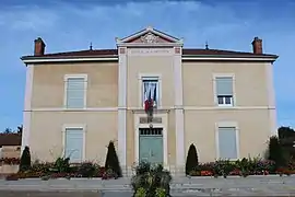 Town hall | |
Location of Crottet | |
 Crottet  Crottet | |
| Coordinates: 46°16′41″N 4°53′34″E / 46.2781°N 4.8928°E | |
| Country | France |
| Region | Auvergne-Rhône-Alpes |
| Department | Ain |
| Arrondissement | Bourg-en-Bresse |
| Canton | Vonnas |
| Intercommunality | CC de la Veyle |
| Government | |
| • Mayor (2020–2026) | Jean-Philippe Lhotelais[1] |
| Area 1 | 12.12 km2 (4.68 sq mi) |
| Population | 1,818 |
| • Density | 150/km2 (390/sq mi) |
| Time zone | UTC+01:00 (CET) |
| • Summer (DST) | UTC+02:00 (CEST) |
| INSEE/Postal code | 01134 /01290 |
| Elevation | 170–213 m (558–699 ft) (avg. 176 m or 577 ft) |
| 1 French Land Register data, which excludes lakes, ponds, glaciers > 1 km2 (0.386 sq mi or 247 acres) and river estuaries. | |
Crottet (French pronunciation: [kʁɔtɛ]; Arpitan: Crotèt) is a commune in the Ain department in eastern France.
Geography
The Veyle forms the commune's southwestern border, then flows into the Saône.
Population
| Year | Pop. | ±% p.a. |
|---|---|---|
| 1968 | 731 | — |
| 1975 | 891 | +2.87% |
| 1982 | 986 | +1.46% |
| 1990 | 1,313 | +3.65% |
| 1999 | 1,477 | +1.32% |
| 2009 | 1,721 | +1.54% |
| 2014 | 1,719 | −0.02% |
| 2020 | 1,792 | +0.70% |
| Source: INSEE[3] | ||
See also
References
- ↑ "Répertoire national des élus: les maires". data.gouv.fr, Plateforme ouverte des données publiques françaises (in French). 2 December 2020.
- ↑ "Populations légales 2021". The National Institute of Statistics and Economic Studies. 28 December 2023.
- ↑ Population en historique depuis 1968, INSEE
Wikimedia Commons has media related to Crottet.
This article is issued from Wikipedia. The text is licensed under Creative Commons - Attribution - Sharealike. Additional terms may apply for the media files.